Gulf Islands National Seashore
National Seashore · Florida, Mississippi
NPS/Doggrell

American seashore along the Gulf of Mexico
Gulf Islands National Seashore is an American national seashore that offers recreation opportunities and preserves natural and historic resources along the Gulf of Mexico barrier islands of Florida, Alabama, and Mississippi. In 2024, it was the sixth-most visited unit of the National Park Service.
About Gulf Islands National Seashore
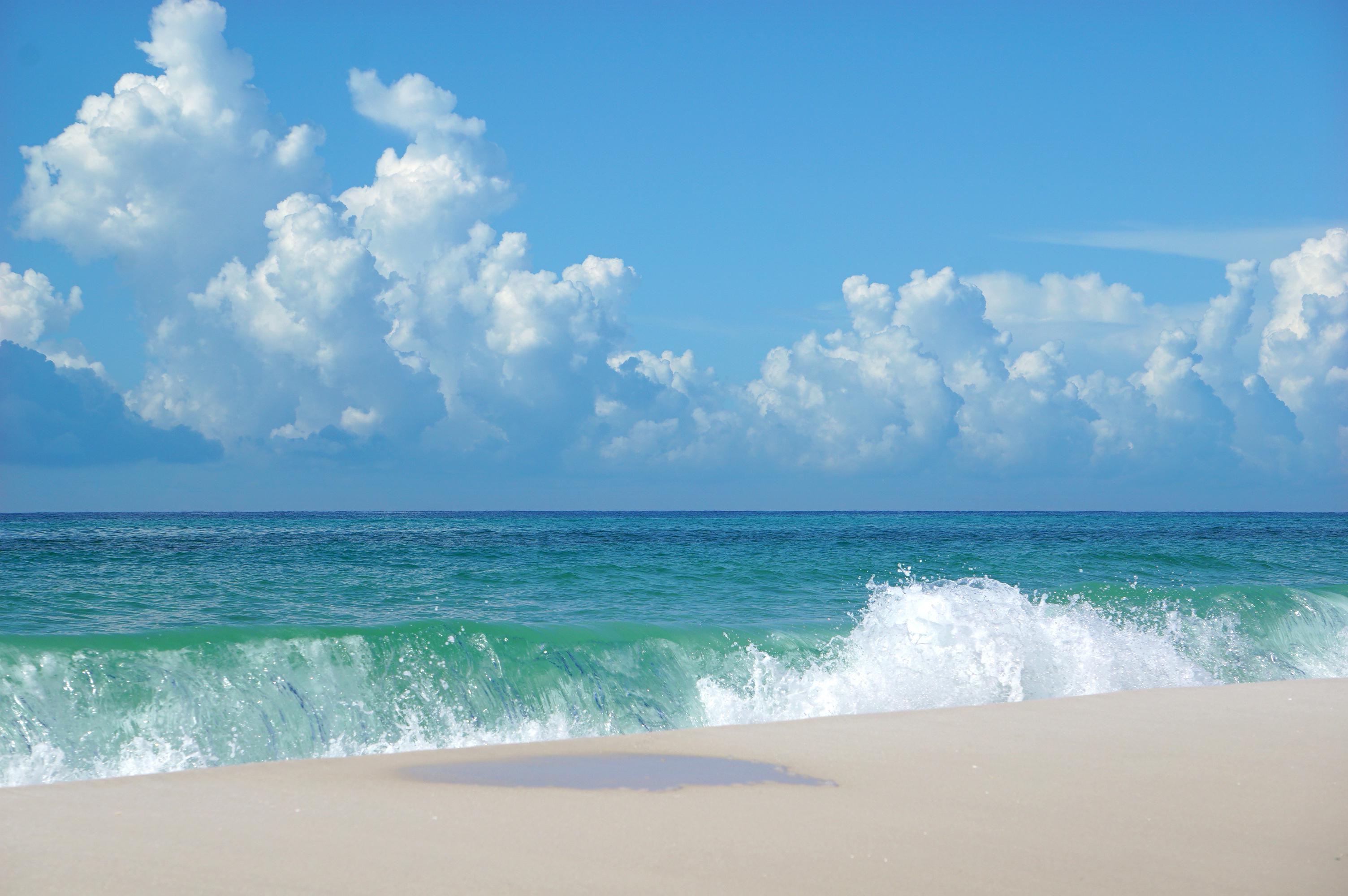
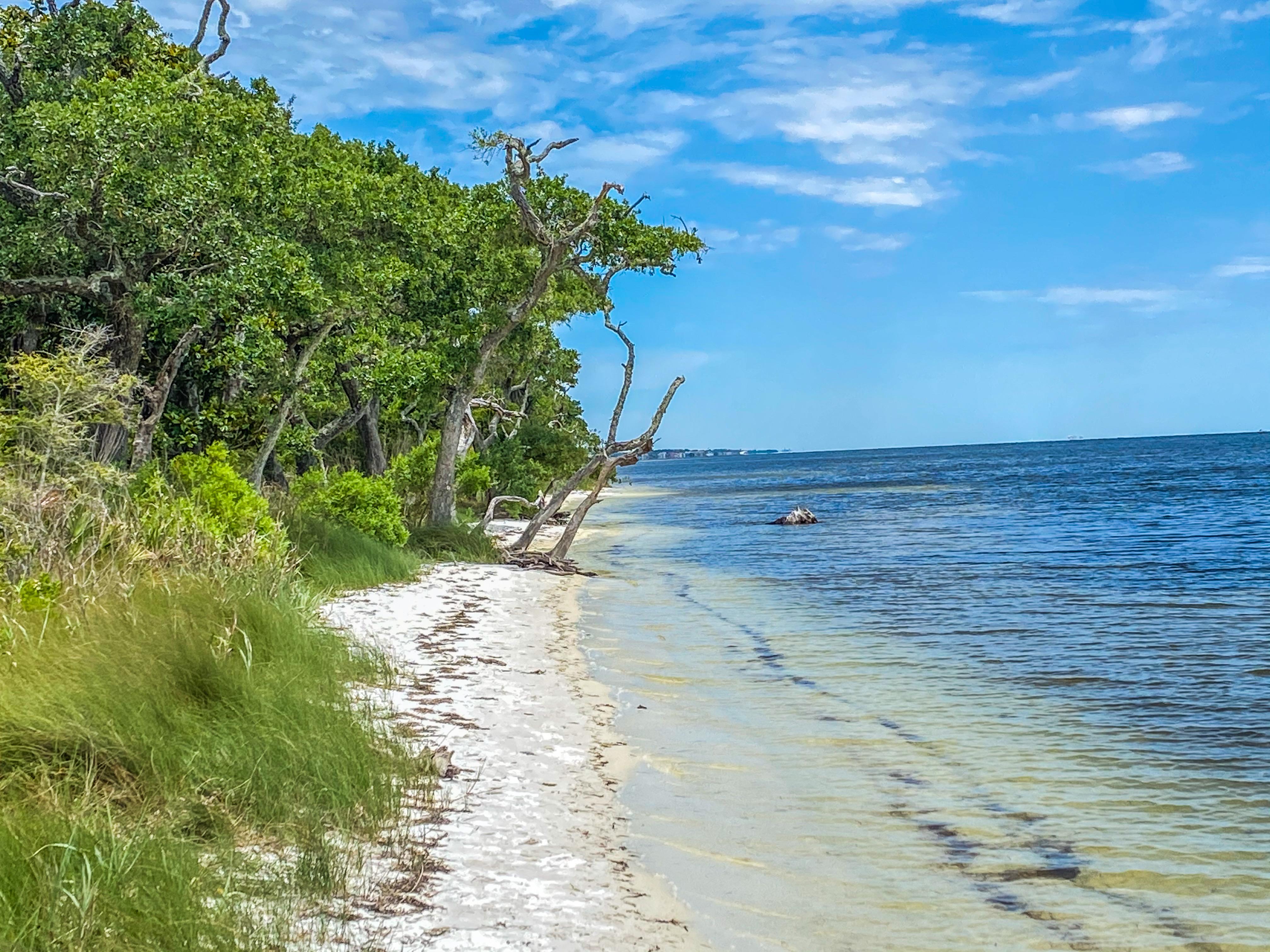
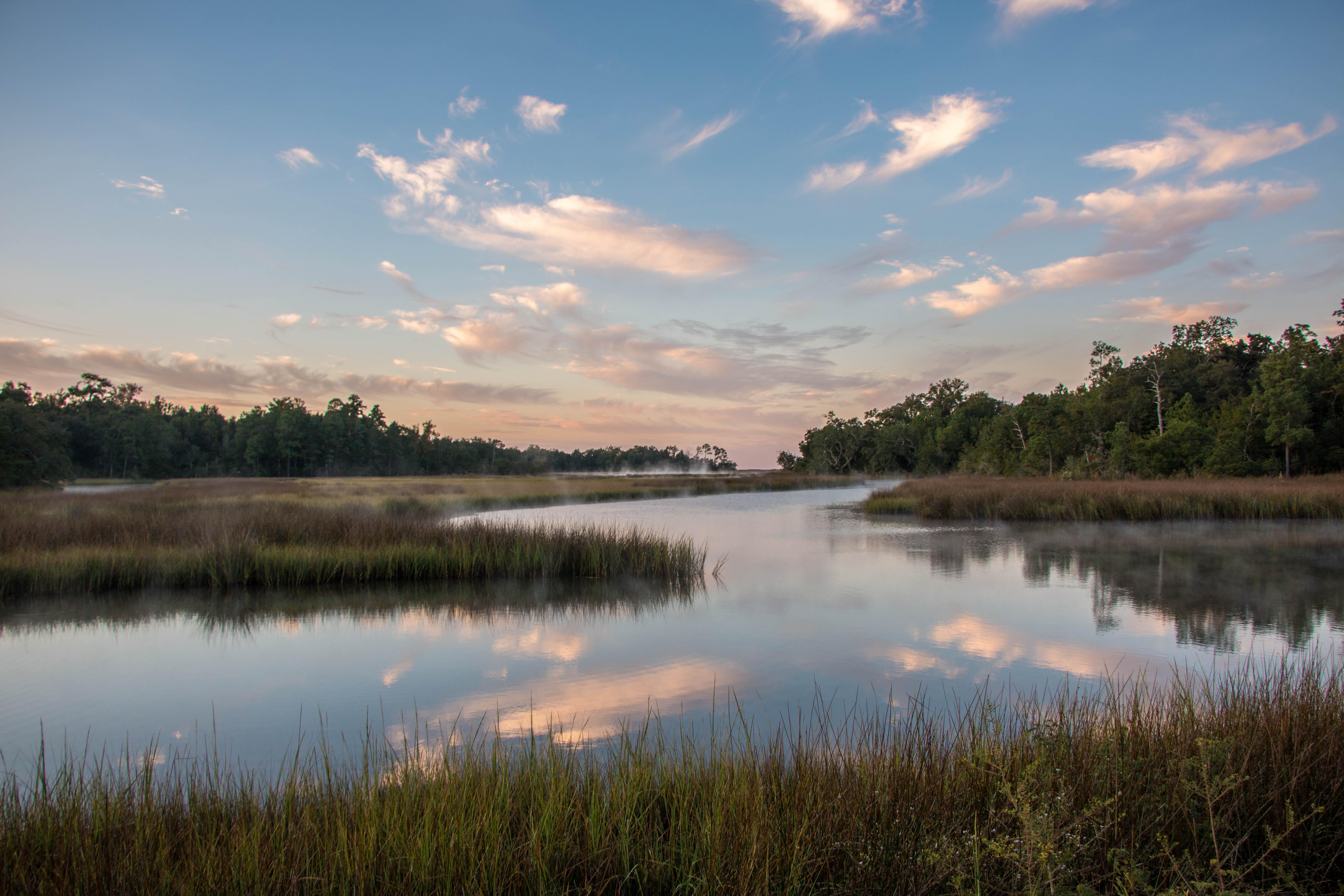
Millions of visitors are drawn to the Gulf of America for Gulf Islands National Seashore's emerald coast waters, magnificent white beaches, fertile marshes and historical landscapes. Come explore with us today!
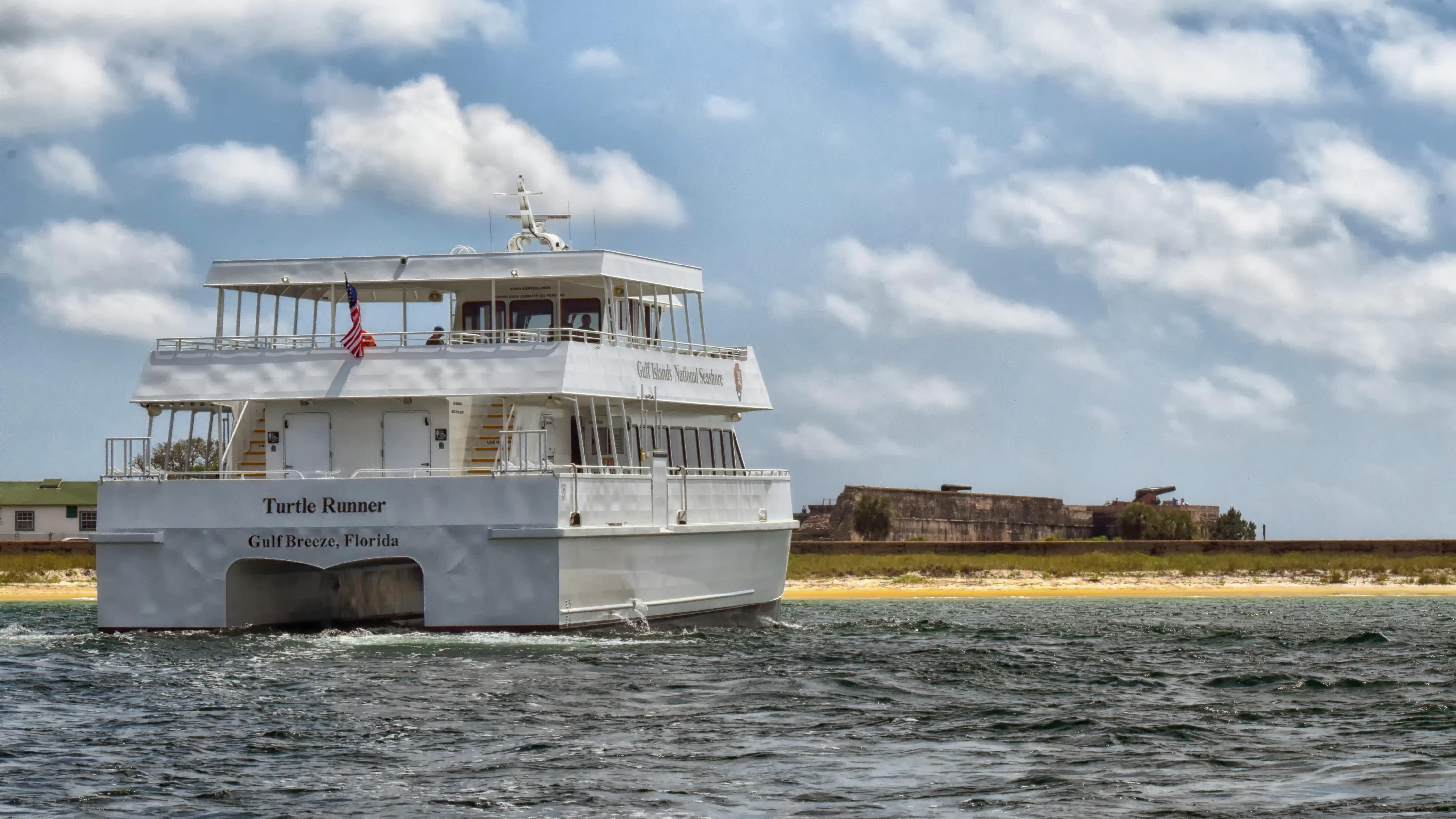
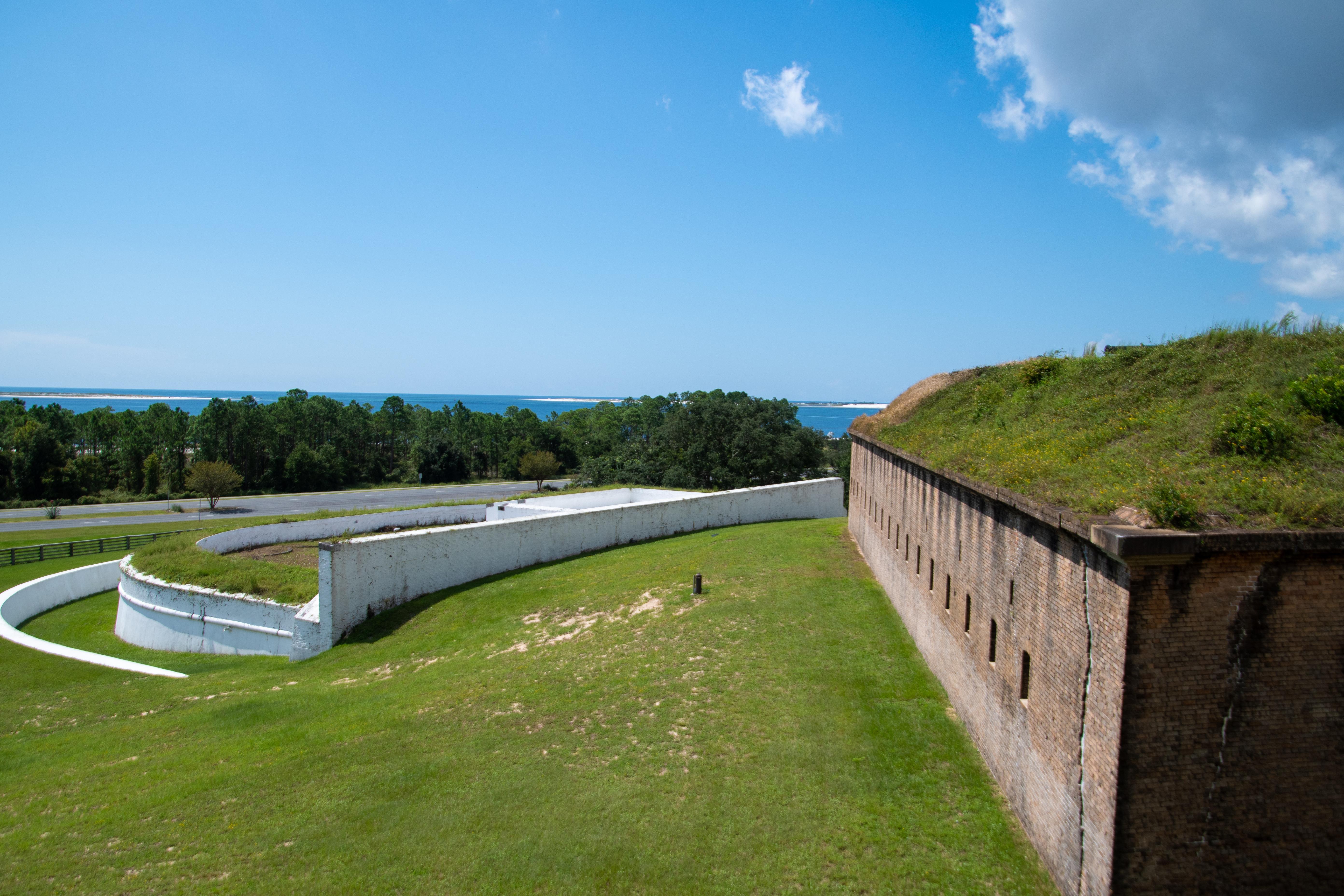
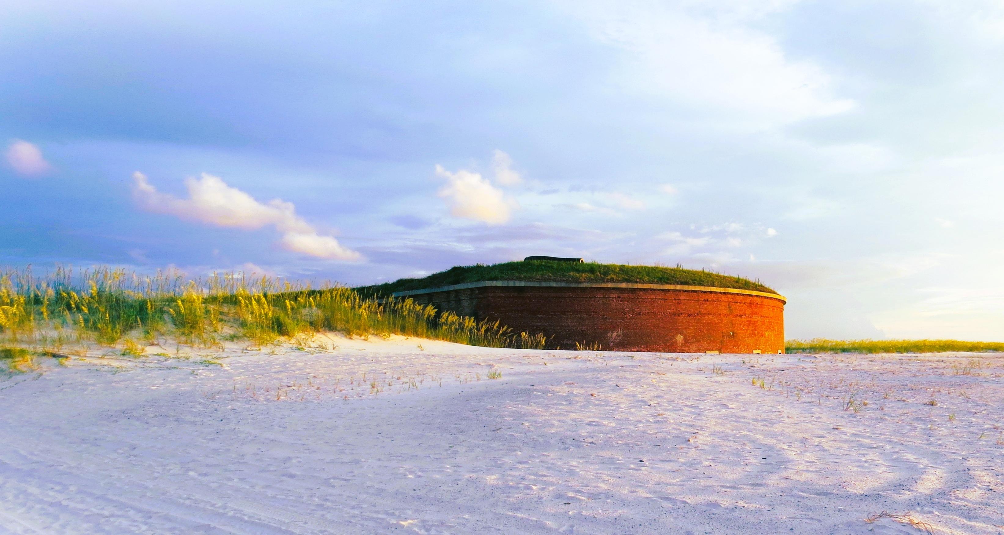
Park Photos
Activities
Operating Hours
Davis Bayou Area
The Davis Bayou Area is located south of U. S. Hwy. 90 east of downtown Ocean Springs, Mississippi and offers many recreational opportunities. Visitors can enjoy fishing, hiking, biking, birdwatching, picnicking, kayaking and ranger-led programs. There are no swimming beaches in the Davis Bayou Area. Visitor Center hours are 9 a.m. to 4 p.m. Wednesday - Sunday.
| mon | tue | wed | thu | fri | sat | sun |
|---|---|---|---|---|---|---|
| 8:00AM - 6:00PM | 8:00AM - 6:00PM | 8:00AM - 6:00PM | 8:00AM - 6:00PM | 8:00AM - 6:00PM | 8:00AM - 6:00PM | 8:00AM - 6:00PM |
Fort Pickens Area
Located on the western end of Santa Rosa Island, the Fort Pickens Area of the park offers a variety of visitor experiences including fishing, hiking, swimming, camping, and touring historic coastal defense structures. There is an entrance fee to visit the Fort Pickens Area. To contact a park ranger, get a stamp, or program information visit the historic Fort Pickens. Park store hours are 9 a.m. to 4:30 p.m.
| mon | tue | wed | thu | fri | sat | sun |
|---|---|---|---|---|---|---|
| 5:00AM - 8:00PM | 5:00AM - 8:00PM | 5:00AM - 8:00PM | 5:00AM - 8:00PM | 5:00AM - 8:00PM | 5:00AM - 8:00PM | 5:00AM - 8:00PM |
Naval Live Oaks Area
Naval Live Oaks is located on U.S. 98 east of Gulf Breeze, Florida. The fee-free area features many hiking trails and an overlook. Also great for fishing or launching a kayak. Additionally, there is a youth group camping and picnic area available by reservation only. Day use area only open form 8 a.m. to 6 p.m. Report to Fort Pickens to purchase park passes and stamps.
| mon | tue | wed | thu | fri | sat | sun |
|---|---|---|---|---|---|---|
| 8:00AM - Sunset | 8:00AM - Sunset | 8:00AM - Sunset | 8:00AM - Sunset | 8:00AM - Sunset | 8:00AM - Sunset | 8:00AM - Sunset |
Okaloosa Area
Located on U.S. 98 on the far eastern end of Santa Rosa Island, the Okaloosa Area of the park offers visitors the opportunity to swim, picnic, as well as a boat launch.
| mon | tue | wed | thu | fri | sat | sun |
|---|---|---|---|---|---|---|
| 8:00AM - Sunset | 8:00AM - Sunset | 8:00AM - Sunset | 8:00AM - Sunset | 8:00AM - Sunset | 8:00AM - Sunset | 8:00AM - Sunset |
Santa Rosa Area
Santa Rosa Area (Opal Beach) is a fragile barrier island made up largely of fine quartz sand held together by plants adapted to this harsh environment. It provides habitat for many shore birds, small animals and nesting sea turtles. An entrance fee is charged at this day-use area. No overnight parking or camping allowed. Santa Rosa is a pack-in and pack-out park so please keep our beaches clean. Glass containers and pets are not allowed on the beaches.
| mon | tue | wed | thu | fri | sat | sun |
|---|---|---|---|---|---|---|
| 8:00AM - 8:00PM | 8:00AM - 8:00PM | 8:00AM - 8:00PM | 8:00AM - 8:00PM | 8:00AM - 8:00PM | 8:00AM - 8:00PM | 8:00AM - 8:00PM |
Perdido Key Area
Perdido Key is located off Florida Route 292 southwest of Pensacola. There is an entrance fee to visit the Perdido Key Area of Gulf Islands National Seashore. Swimming, boating, fishing, hiking, and primitive camping are available year-round. No overnight parking allowed.
| mon | tue | wed | thu | fri | sat | sun |
|---|---|---|---|---|---|---|
| 5:00AM - 8:00PM | 5:00AM - 8:00PM | 5:00AM - 8:00PM | 5:00AM - 8:00PM | 5:00AM - 8:00PM | 5:00AM - 8:00PM | 5:00AM - 8:00PM |
Petit Bois Island
This barrier island is located roughly 10 miles off the Mississippi coast and offers dramatic scenery, but limited facilities. The island is accessible year round by private boat. Primitive camping is allowed on the island. (Groups of 10 or more are required to get a permit).
| mon | tue | wed | thu | fri | sat | sun |
|---|---|---|---|---|---|---|
| All Day | All Day | All Day | All Day | All Day | All Day | All Day |
West Petit Bois Island
This barrier island is located roughly 10 miles off the Mississippi coast and offers dramatic scenery, but limited facilities. The island is accessible year-round by private boat. This island is protected by the wilderness act and all activities with groups of 10 or more are required to get a permit to include camping.
| mon | tue | wed | thu | fri | sat | sun |
|---|---|---|---|---|---|---|
| All Day | All Day | All Day | All Day | All Day | All Day | All Day |
Horn Island
This barrier island is located roughly 10 miles off the Mississippi coast and offers dramatic scenery, but limited facilities. The island is accessible year-round by private boat. This island is protected by the wilderness act and all activities with groups of 10 or more are required to get a permit to include camping.
| mon | tue | wed | thu | fri | sat | sun |
|---|---|---|---|---|---|---|
| All Day | All Day | All Day | All Day | All Day | All Day | All Day |
Ship Island
This barrier island is located roughly 10 miles off the Mississippi coast. Free tours and exhibits at Fort Massachusetts, a swim beach, pavilions, restrooms, showers, and snack bar are available seasonally. A passenger ferry is available March through October, and the island is accessible year-round by private boat. Camping is not permitted on Ship Island. For Massachusetts is open 10:15 am - 2:15 pm Wednesday - Sunday during the operating season.
| mon | tue | wed | thu | fri | sat | sun |
|---|---|---|---|---|---|---|
| Closed | Closed | 10:00AM - Sunset | 10:00AM - Sunset | 10:00AM - Sunset | 10:00AM - Sunset | 10:00AM - Sunset |
Cat Island
This barrier island is located roughly 10 miles off the Mississippi coast and offers dramatic scenery, but limited facilities. The island is accessible year round by private boat. Primitive camping is allowed on the National Park Service owned portion of the island. (Groups of 10 or more are required to get a permit).
| mon | tue | wed | thu | fri | sat | sun |
|---|---|---|---|---|---|---|
| All Day | All Day | All Day | All Day | All Day | All Day | All Day |
Fort Barrancas Area
The Fort Barrancas Visitor Center, Fort Barrancas, and Spanish Water Battery are open on select days from 9 am–4 pm, with last entry to Fort Barrancas and the Spanish Water Battery at 3:30 pm. Advanced Redoubt (exterior only) is open daily 9 am–4 pm. The Fort Barrancas Visitor Center, Fort Barrancas, and Spanish Water Battery are open on the fourth Friday of every month.
| mon | tue | wed | thu | fri | sat | sun |
|---|---|---|---|---|---|---|
| Closed | Closed | Closed | Closed | Closed | Closed | Closed |
Gulf Islands National Seashore park store at Fort Pickens
Currently the only park store in Gulf Islands National Seashore is located in the entrance to Fort Pickens. This is seven miles from the Fort Pickens Entrance Station. From the parking lot of the fort look for the arch in the fort and the store is on the right. Items can only be purchased instore. This is a primary location for park stamps. Park store is subject to closures due to weather and/or holidays.
| mon | tue | wed | thu | fri | sat | sun |
|---|---|---|---|---|---|---|
| 9:00AM - 4:30PM | 9:00AM - 4:30PM | 9:00AM - 4:30PM | 9:00AM - 4:30PM | 9:00AM - 4:30PM | 9:00AM - 4:30PM | 9:00AM - 4:30PM |
Frequently Asked Questions
How much does it cost to enter Gulf Islands National Seashore?
Entrance - Private Vehicle: $25.00. Cost for up to six people in one vehicle. Good for seven days into any fee area in Florida, (Opal Beach, Johnson Beach, Fort Pickens). Entrance - Motorcycle: $20.00. Valid for 7 days. Admits up to 2 private, non-commercial motorcycles with up to 4 total passengers. Fees are required at Fort Pickens Area, Opal Beach Complex Area, and Johnson Beach Area in Florida. Additional fees to ride the ferry. Entrance - Per Person: $15.00. Fees are required at Fort Pickens Area, Opal Beach Complex Area, and Johnson Beach Area in Florida. Additional fees to ride the ferry.
What are the best activities at Gulf Islands National Seashore?
Popular activities at Gulf Islands National Seashore include: Biking, Mountain Biking, Road Biking, Boating, Motorized Boating, Jet Skiing, Boat Tour, Camping.
What is the weather like at Gulf Islands National Seashore?
Weather along the northern coast of the Gulf of Mexico can change quickly. During the winter temperatures range from 30-60 degrees fahrenheit, rain is less common than other seasons. Snow and freezing temperatures are not common. During the summer temperatures range from 70-100+ degrees fahrenheit. Rain is common during the summer with many thunderstorms. Hurricanes impact the area during the tropical storm season between June and November. Tornadoes can impact the area during the Spring and Fall.
How do I get to Gulf Islands National Seashore?
Gulf Islands National Seashore is a place of myriad riches - blue-green, sparkling waters, magnificent white beaches, and fertile coastal marshes. Its 13 areas include historic forts, shaded picnic areas, trails, and campgrounds. From Cat Island, Mississippi, it stretches eastward 160 miles tot he Okaloosa Area east of For Walton Beach, Florida.
Entrance Fees
Cost for up to six people in one vehicle. Good for seven days into any fee area in Florida, (Opal Beach, Johnson Beach, Fort Pickens).
Valid for 7 days. Admits up to 2 private, non-commercial motorcycles with up to 4 total passengers. Fees are required at Fort Pickens Area, Opal Beach Complex Area, and Johnson Beach Area in Florida. Additional fees to ride the ferry.
Fees are required at Fort Pickens Area, Opal Beach Complex Area, and Johnson Beach Area in Florida. Additional fees to ride the ferry.
Weather
Weather along the northern coast of the Gulf of Mexico can change quickly. During the winter temperatures range from 30-60 degrees fahrenheit, rain is less common than other seasons. Snow and freezing temperatures are not common. During the summer temperatures range from 70-100+ degrees fahrenheit. Rain is common during the summer with many thunderstorms. Hurricanes impact the area during the tropical storm season between June and November. Tornadoes can impact the area during the Spring and Fall.
Directions
Gulf Islands National Seashore is a place of myriad riches - blue-green, sparkling waters, magnificent white beaches, and fertile coastal marshes. Its 13 areas include historic forts, shaded picnic areas, trails, and campgrounds. From Cat Island, Mississippi, it stretches eastward 160 miles tot he Okaloosa Area east of For Walton Beach, Florida.
📍 View on Google Maps →Location
Official Resources
NPS Official WebsiteMore Parks in Florida
Other national park sites you might enjoy