Bighorn Canyon National Recreation Area
National Recreation Area · Montana, Wyoming
Sharron Genaux

National recreation area in the United States
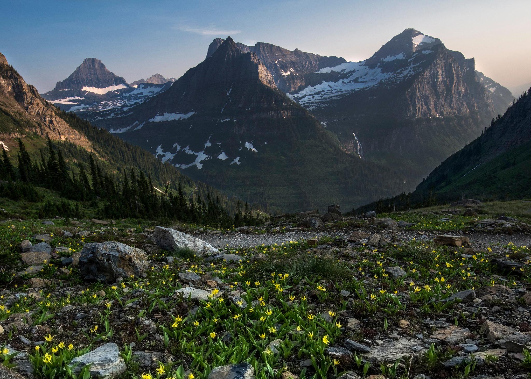
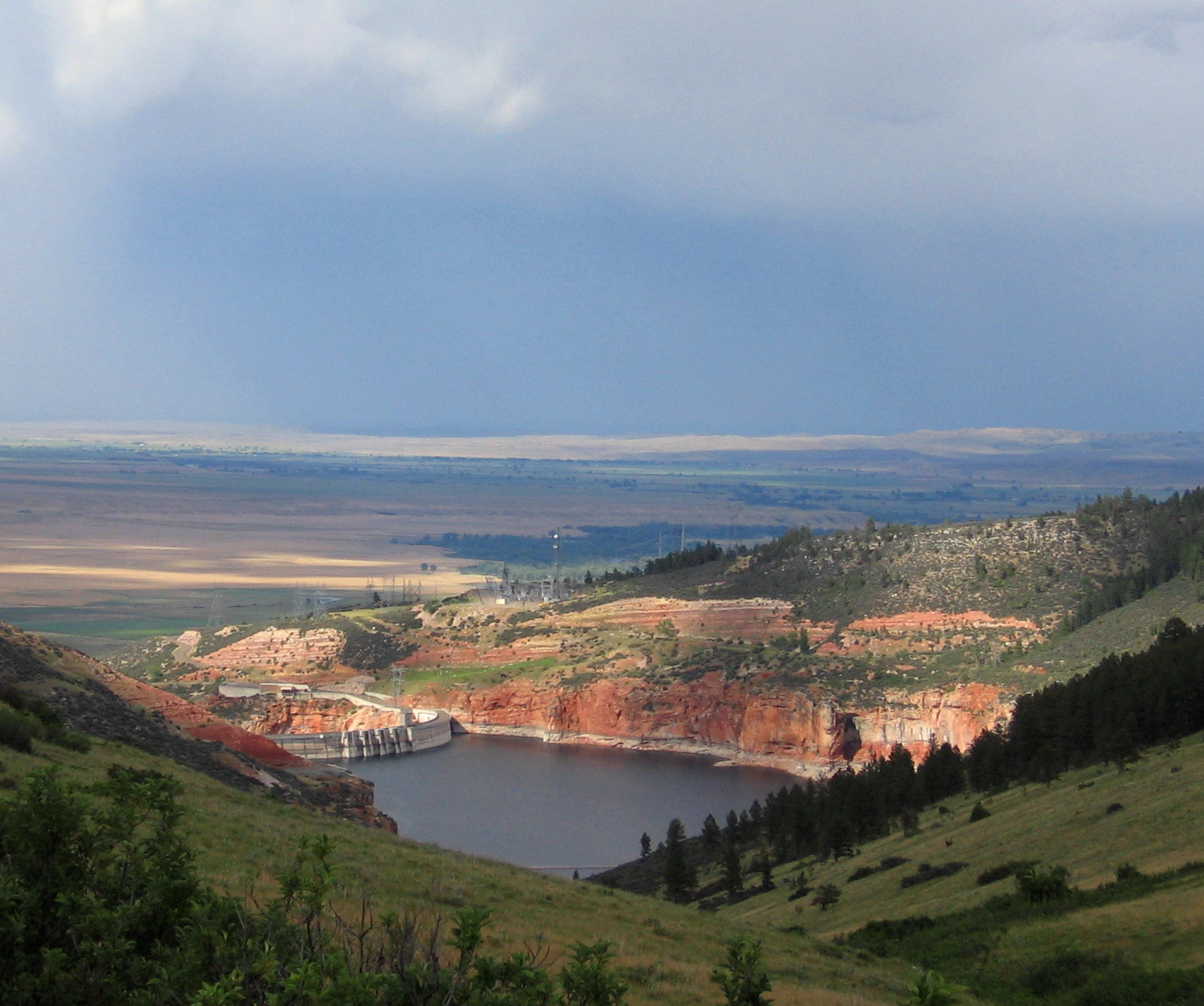
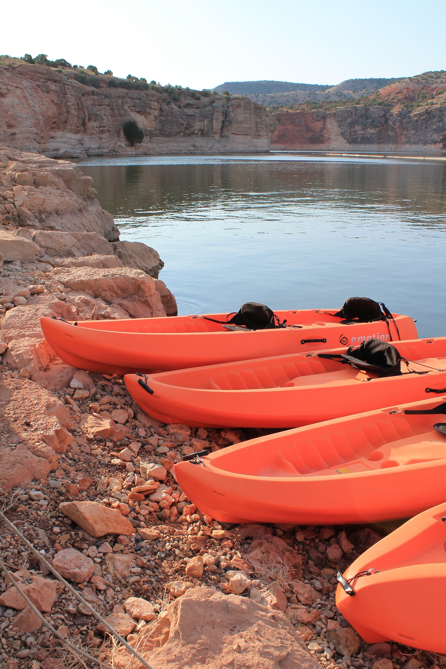
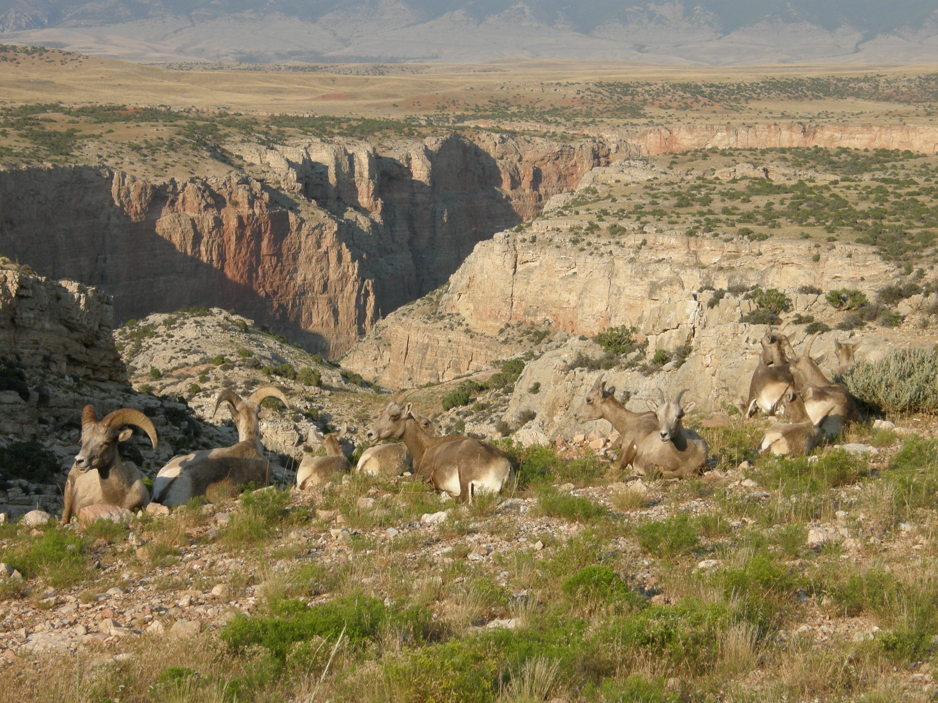
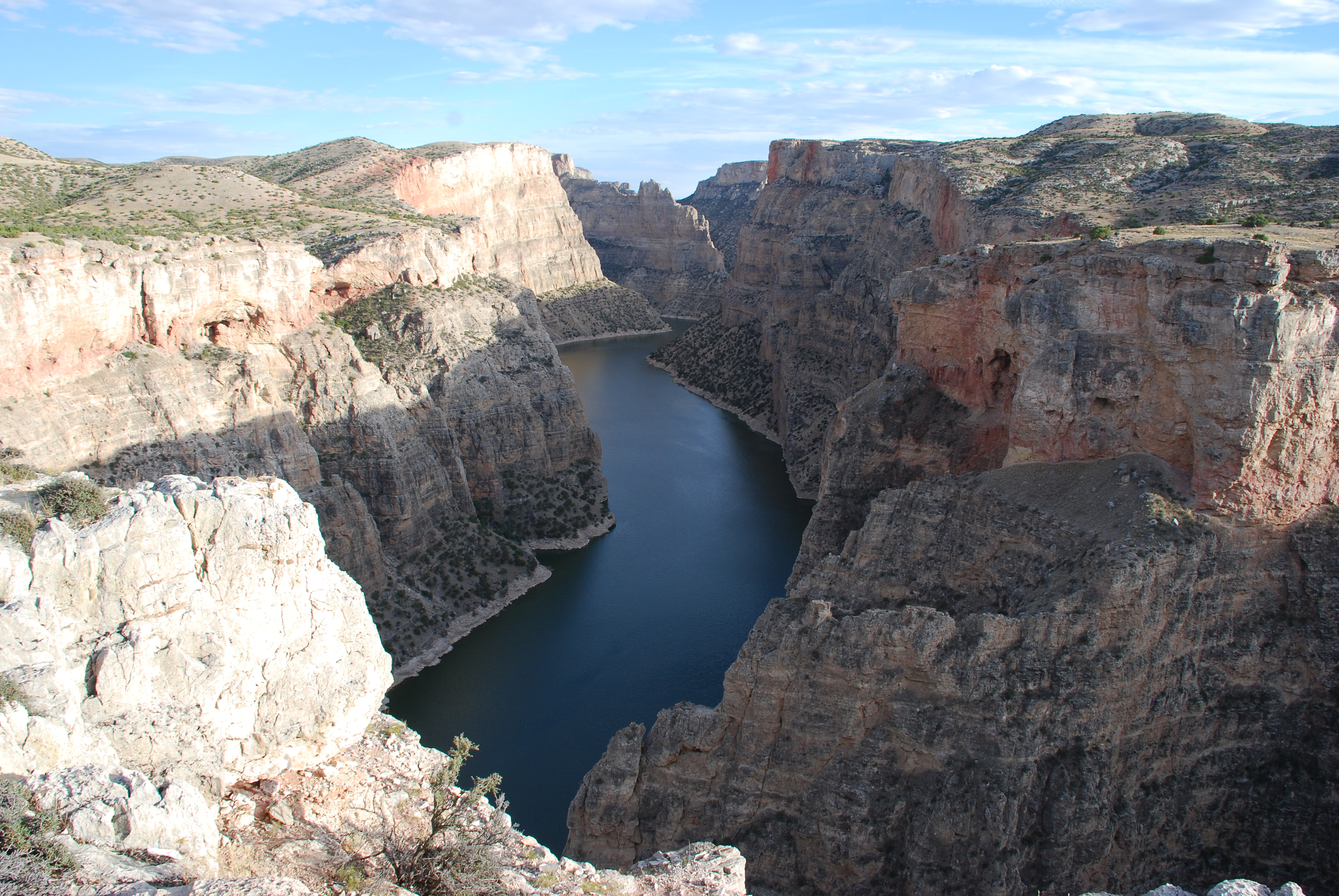
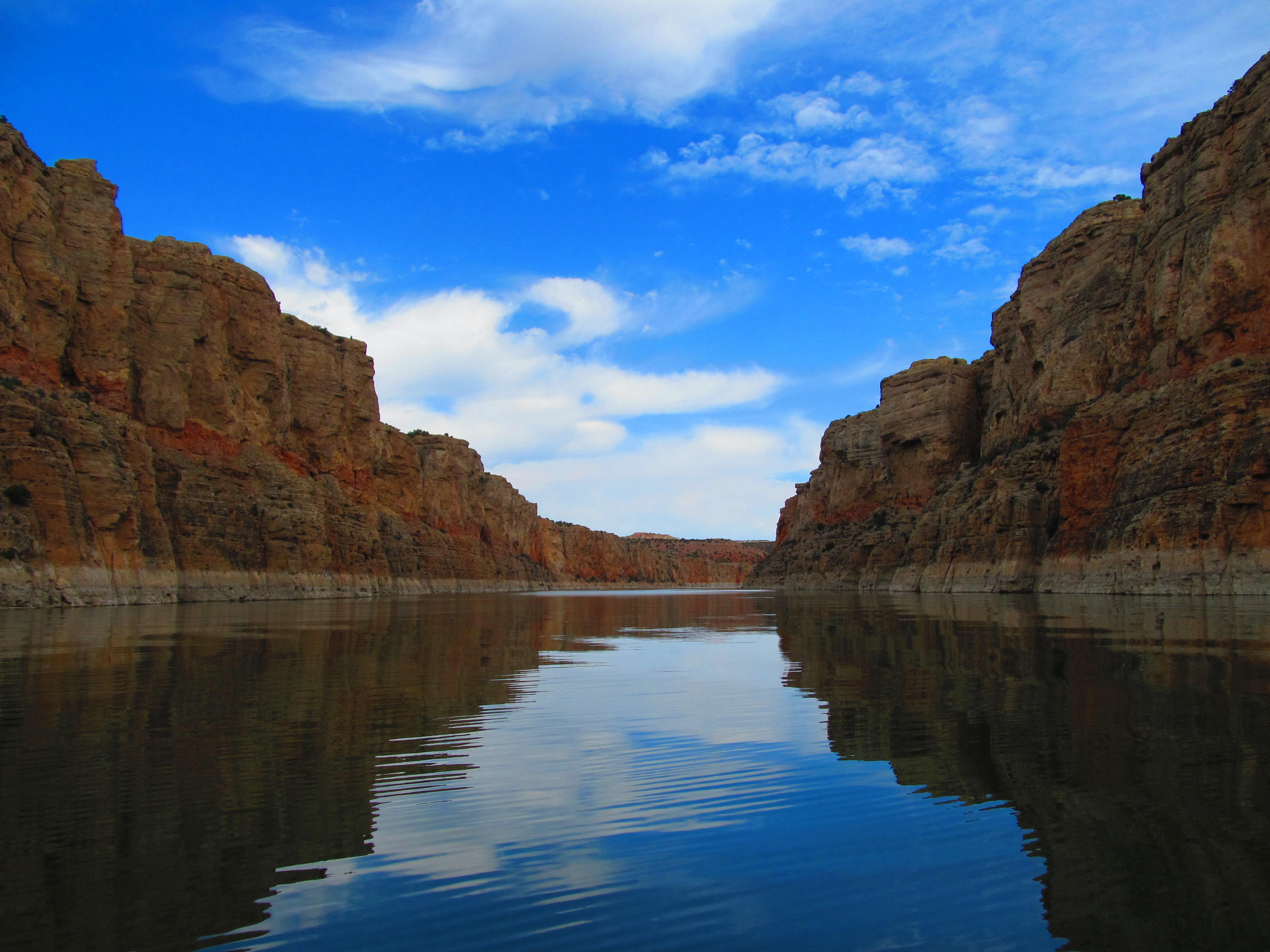
Bighorn Canyon National Recreation Area is a national recreation area established by an act of Congress on October 15, 1966, following the construction of the Yellowtail Dam by the Bureau of Reclamation. It is one of over 420 sites managed by the U.S. National Park Service. The recreation area spans 120,296.22 acres, straddling the border between Wyoming and Montana. It is divided into two distinct areas, the North District accessed via Fort Smith, Montana and the South District accessed through Lovell, Wyoming. There is no thru road inside the recreation area connecting the two districts. The Yellowtail Dam is located in the North District. It is named after the famous Crow leader Robert Yellowtail, harnesses the waters of the Bighorn River by turning that variable watercourse into Bighorn Lake. The lake extends 71 miles (114 km) through Wyoming and Montana, 55 miles (89 km) of which lie within the national recreation area. The lake provides recreational boating, fishing, water skiing, kayaking, and birding opportunities to visitors. About one third of the park unit is located on the Crow Indian Reservation. Nearly one-quarter of the Pryor Mountains Wild Horse Range lies within the Bighorn Canyon National Recreation Area.
About Bighorn Canyon National Recreation Area
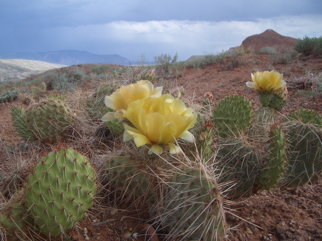
The vast, wild landscape of Bighorn Canyon National Recreation Area offers visitors unparalleled opportunities to immerse themselves in the natural world, and experience the wonders of this extraordinary place. With over 120,000 acres, one can find an astounding diversity in ecosystems, wildlife, and more than 10,000 years of human history to explore.
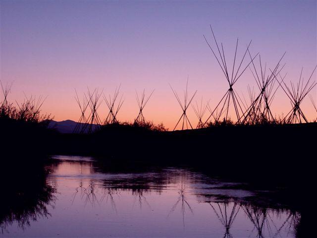
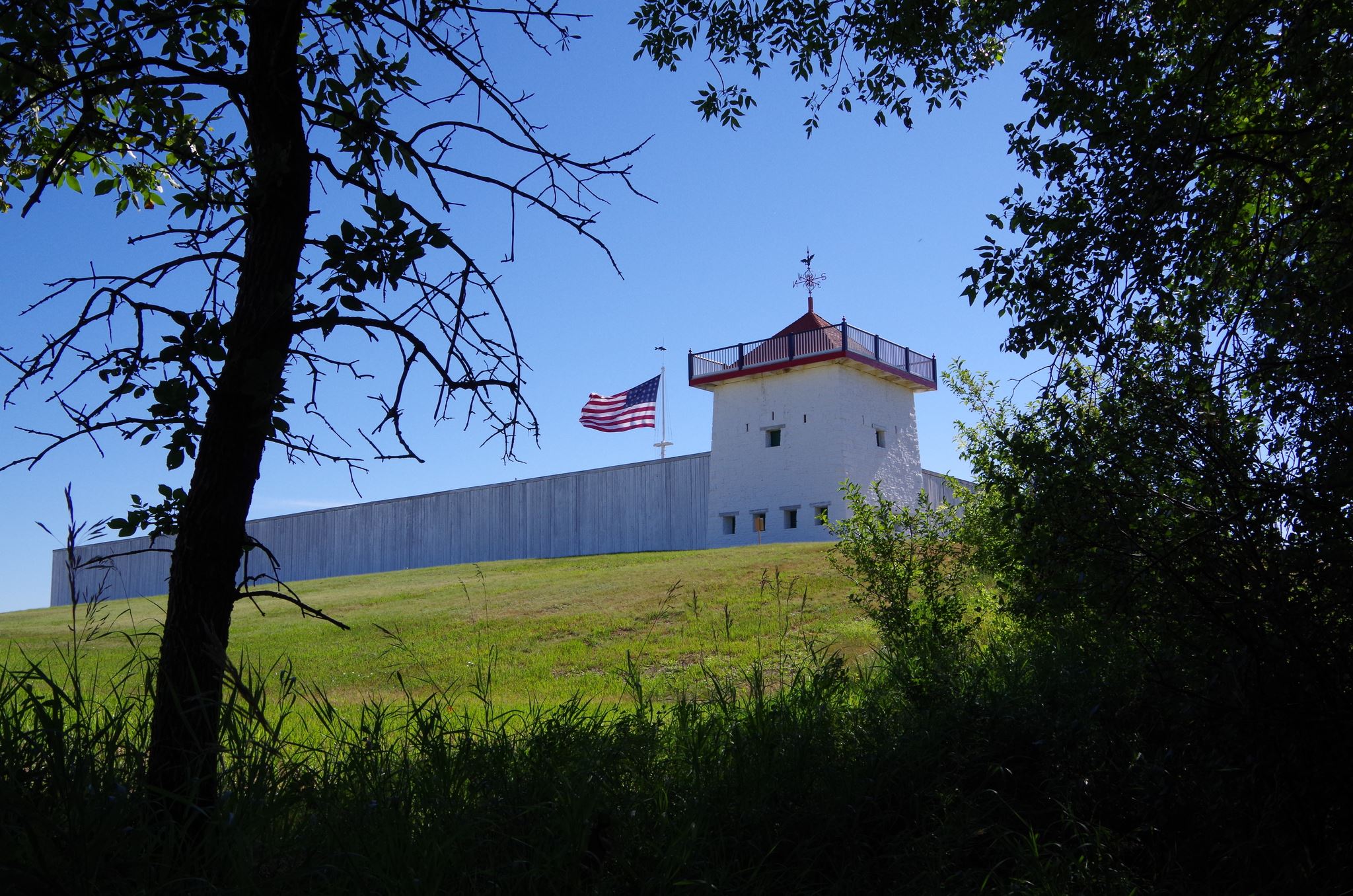
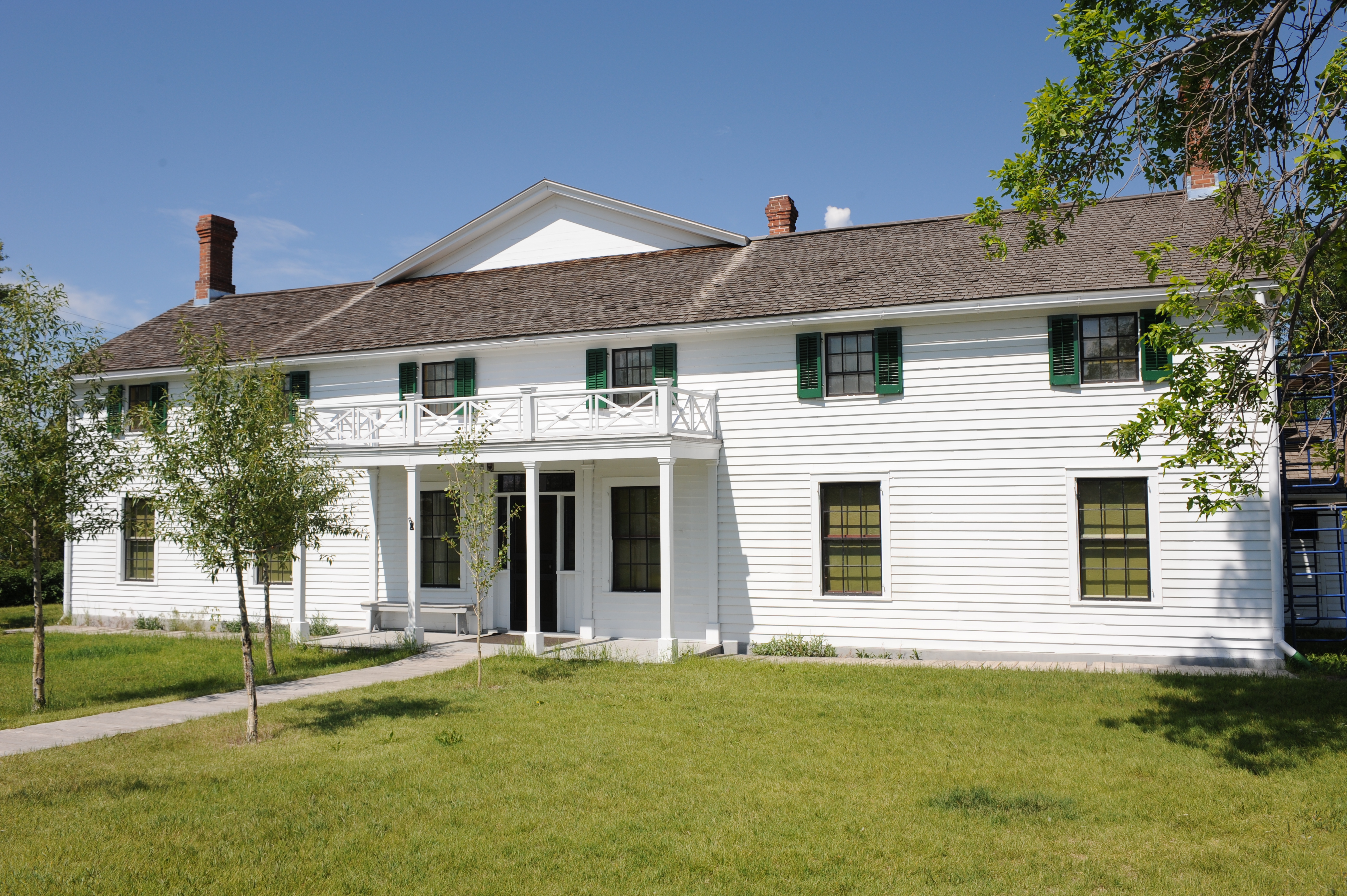
Park Photos
Activities
Operating Hours
Bighorn Canyon National Recreation Area
The park is open every day. The Yellowtail Dam Visitor Center in Fort Smith, MT is only open in the summer from Memorial Day to Labor Day. The Cal S. Taggart visitor center in Lovell, WY operates on seasonal hours; Summer Hours (Memorial Day to Labor Day): 8:30 AM to 4:30 PM; Seven days a week. Winter Hours (Labor Day to Memorial Day): 8:30 AM to 4:30 PM; Tuesday through Saturday. Closed Sundays and Mondays.
| mon | tue | wed | thu | fri | sat | sun |
|---|---|---|---|---|---|---|
| 8:30AM - 4:30PM | 8:30AM - 4:30PM | 8:30AM - 4:30PM | 8:30AM - 4:30PM | 8:30AM - 4:30PM | 8:30AM - 4:30PM | 8:30AM - 4:30PM |
Winter Hours: Lovell, WY Visitor Center
The Cal Taggart Visitor Center is opened Tuesday-Saturday from 8:30am-4:30pm.
| mon | tue | wed | thu | fri | sat | sun |
|---|---|---|---|---|---|---|
| Closed | 8:30AM - 4:30PM | 8:30AM - 4:30PM | 8:30AM - 4:30PM | 8:30AM - 4:30PM | 8:30AM - 4:30PM | Closed |
Frequently Asked Questions
How much does it cost to enter Bighorn Canyon National Recreation Area?
Bighorn Canyon National Recreation Area is free to enter.
What are the best activities at Bighorn Canyon National Recreation Area?
Popular activities at Bighorn Canyon National Recreation Area include: Arts and Culture, Theater, Auto and ATV, Scenic Driving, Astronomy, Stargazing, Biking, Road Biking.
What is the weather like at Bighorn Canyon National Recreation Area?
North District: Semi-arid, receiving 18 to 20 inches of rain annually. South District: High-desert, receiving 6 to 10 inches of rain annually. Summer temperatures: Highs in the 80s (F) and 90s (F), lows in the 50s (F) and 60s (F). Summer temperatures can peak over 100 degrees. Winter temperatures: Range in the 20s and 30s with low temperatures averaging the 10s (F) and 20s (F). During the winter the thermometer can drop below 0 (F) with extreme wind chill factors.
How do I get to Bighorn Canyon National Recreation Area?
Bighorn Canyon has two districts that are separated by a three hour drive. To get to the North District at Fort Smith, MT from Billings, take Interstate 90 south to Hardin, MT. Turn at exit 495 onto State Highway 313 to St. Xavier and then to Fort Smith, Montana. To get to the South District at Lovell, WY from Billings, MT, take Interstate 90 west. Turn at exit 434 at Laurel, MT. Turn onto US 310 East/US 212 South. Turn at US 310 East to Lovell. The visitor center is on the east side of Lovell.
Entrance Fees
Free Admission
Weather
North District: Semi-arid, receiving 18 to 20 inches of rain annually. South District: High-desert, receiving 6 to 10 inches of rain annually. Summer temperatures: Highs in the 80s (F) and 90s (F), lows in the 50s (F) and 60s (F). Summer temperatures can peak over 100 degrees. Winter temperatures: Range in the 20s and 30s with low temperatures averaging the 10s (F) and 20s (F). During the winter the thermometer can drop below 0 (F) with extreme wind chill factors.
Directions
Bighorn Canyon has two districts that are separated by a three hour drive. To get to the North District at Fort Smith, MT from Billings, take Interstate 90 south to Hardin, MT. Turn at exit 495 onto State Highway 313 to St. Xavier and then to Fort Smith, Montana. To get to the South District at Lovell, WY from Billings, MT, take Interstate 90 west. Turn at exit 434 at Laurel, MT. Turn onto US 310 East/US 212 South. Turn at US 310 East to Lovell. The visitor center is on the east side of Lovell.
📍 View on Google Maps →Location
Official Resources
NPS Official WebsiteMore Parks in Montana
Other national park sites you might enjoy