Curecanti National Recreation Area
National Recreation Area · Colorado
NPS image by Matt Johnson

National Park Service in Colorado, US
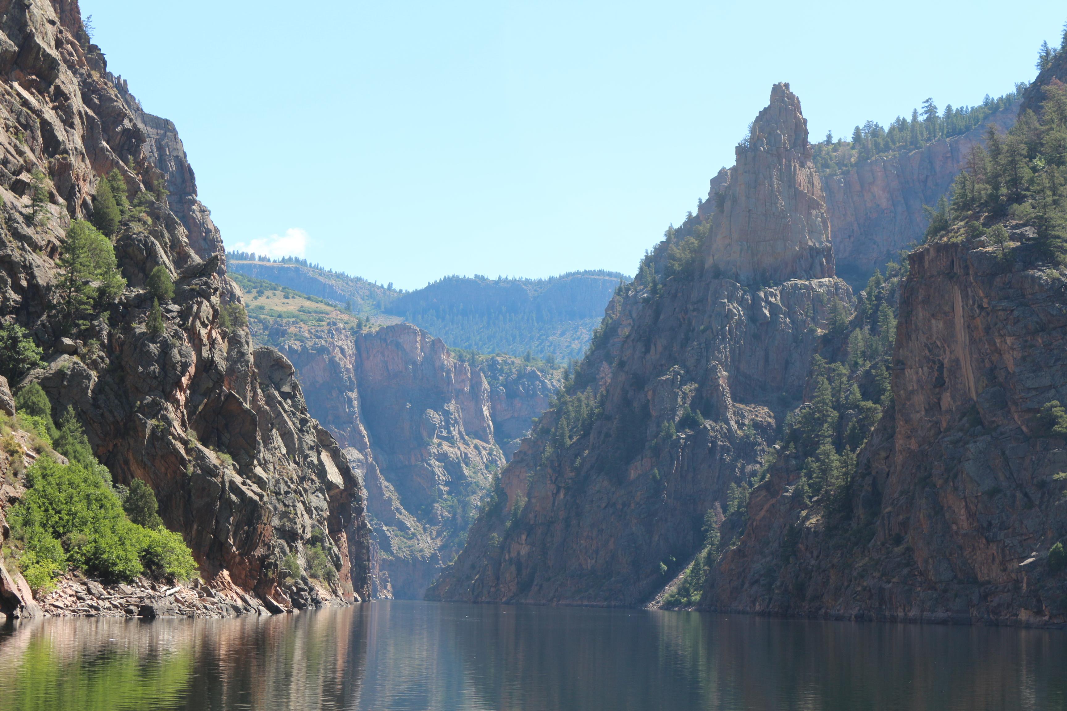
Curecanti National Recreation Area is a National Park Service unit located on the Gunnison River in western Colorado. Established in 1965, Curecanti National Recreation Area is responsible for developing and managing recreational facilities on three reservoirs, Blue Mesa Reservoir, Morrow Point Reservoir and Crystal Reservoir, constructed on the upper Gunnison River in the 1960s by the U.S. Bureau of Reclamation to better utilize the vital waters of the Colorado River and its major tributaries. A popular destination for boating and fishing, Curecanti offers visitors two marinas, traditional and group campgrounds, hiking trails, boat launches, and boat-in campsites. The state's premiere lake trout and Kokanee salmon fisheries, Curecanti is a popular destination for boating and fishing, and is also a popular area for ice-fishing in the winter months.
About Curecanti National Recreation Area
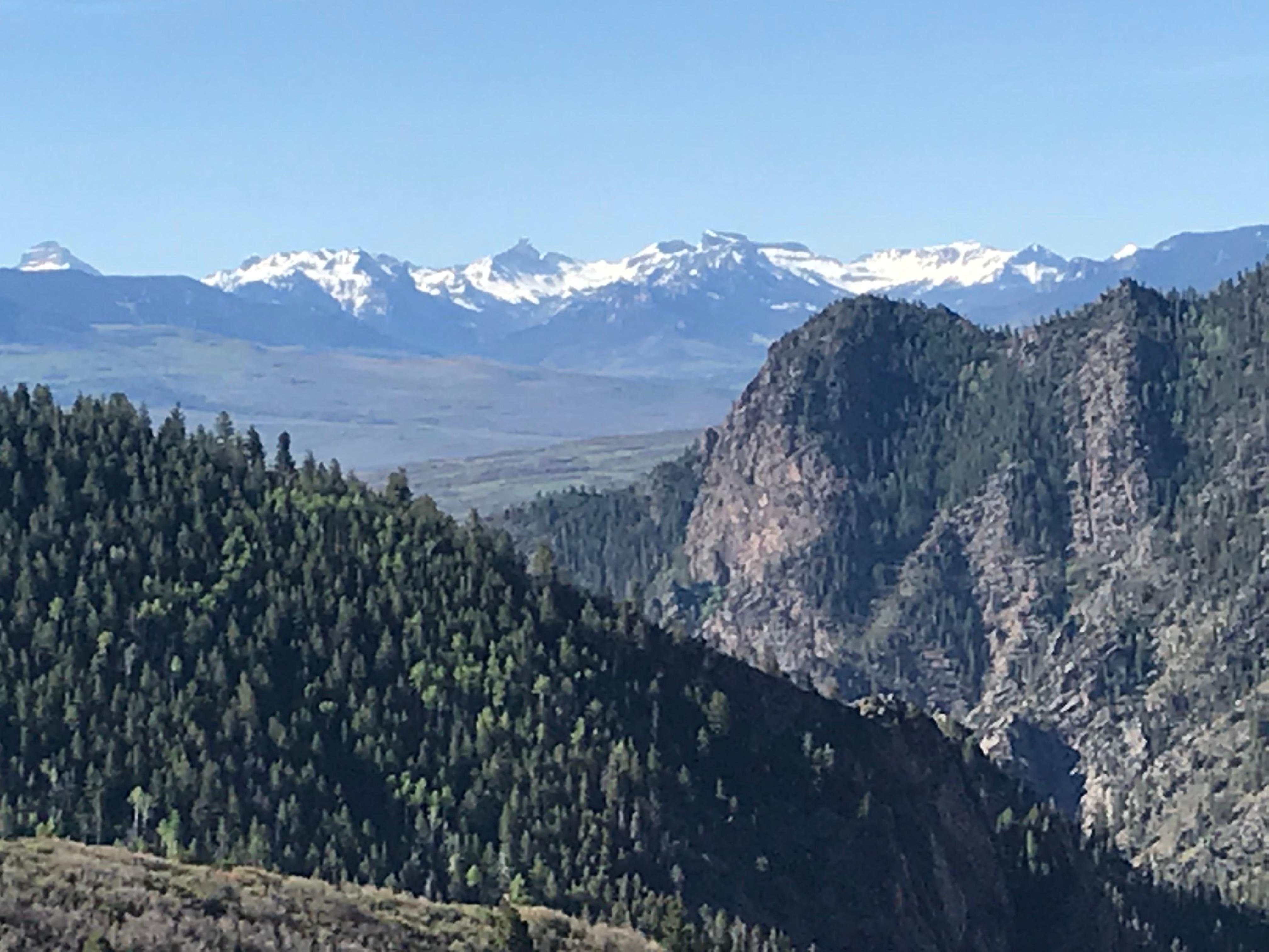
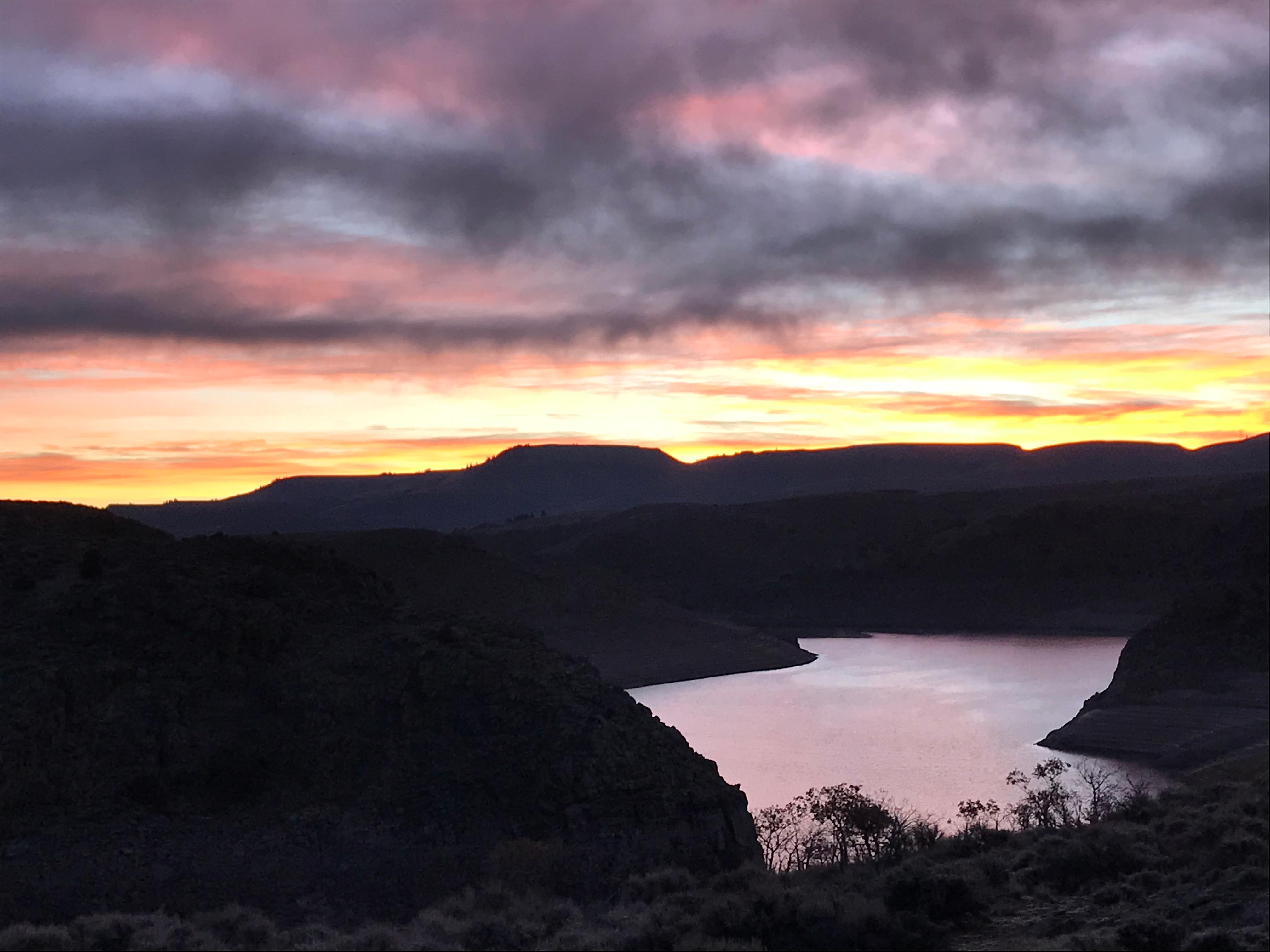
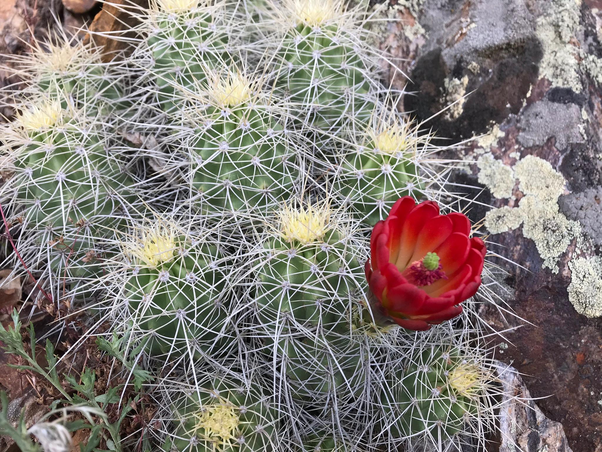
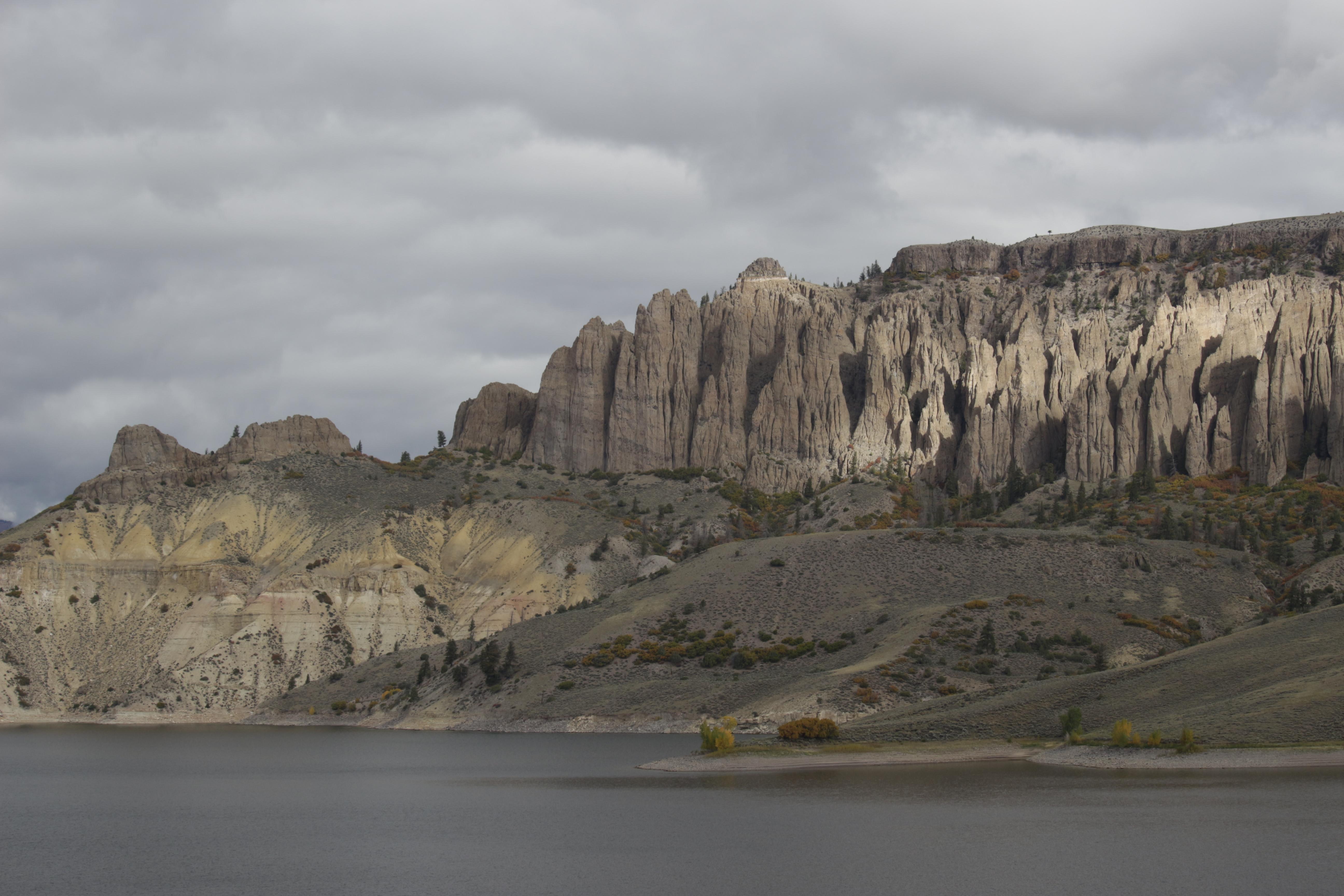
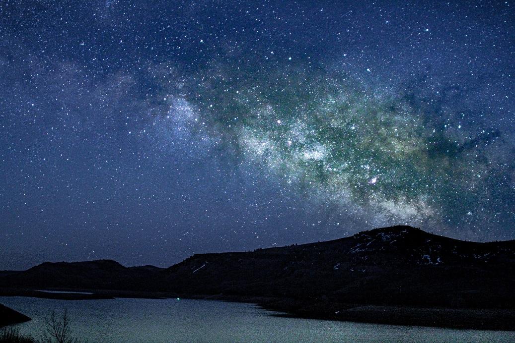
Three reservoirs and surrounding lands make up this recreation area in western Colorado. It is a landscape of tradeoffs; natural and human made features exist together. Geologic wonders are abundant from the sagebrush shrublands to forests. Visitors can experience the park year-round on both land and water.
Park Photos
Activities
Operating Hours
Curecanti National Recreation Area
Open 24 hours per day, 365 days a year.
| mon | tue | wed | thu | fri | sat | sun |
|---|---|---|---|---|---|---|
| All Day | All Day | All Day | All Day | All Day | All Day | All Day |
Frequently Asked Questions
How much does it cost to enter Curecanti National Recreation Area?
Curecanti National Recreation Area is free to enter.
What are the best activities at Curecanti National Recreation Area?
Popular activities at Curecanti National Recreation Area include: Astronomy, Stargazing, Boating, Motorized Boating, Sailing, Jet Skiing, Camping, Backcountry Camping.
What is the weather like at Curecanti National Recreation Area?
During spring and fall, temperatures range from 44°F to 70°F (7°C to 34°C) with overnight lows from the teens to about freezing (-9°C to 2°C). In summer, temperatures are usually in the 70°F to 80°F (21°C to 27°C). Nights are usually 40°F to 50°F (4°C to 10°C). The wind often picks up at 12 pm and continues through the afternoon. Thunderstorms are common. In winter, temperatures usually reach 20°F to 30°F (-7°C to -1°C) and lows often dip below zero (-18°C).
How do I get to Curecanti National Recreation Area?
Curecanti is located between the Colorado towns of Gunnison (to the east), Montrose (to the west), and Lake City (to the south). The West Elk Mountain Wilderness area borders Curecanti to the north. U.S. Highway 50 runs the length of Curecanti east to west.
Entrance Fees
Free Admission
Weather
During spring and fall, temperatures range from 44°F to 70°F (7°C to 34°C) with overnight lows from the teens to about freezing (-9°C to 2°C). In summer, temperatures are usually in the 70°F to 80°F (21°C to 27°C). Nights are usually 40°F to 50°F (4°C to 10°C). The wind often picks up at 12 pm and continues through the afternoon. Thunderstorms are common. In winter, temperatures usually reach 20°F to 30°F (-7°C to -1°C) and lows often dip below zero (-18°C).
Directions
Curecanti is located between the Colorado towns of Gunnison (to the east), Montrose (to the west), and Lake City (to the south). The West Elk Mountain Wilderness area borders Curecanti to the north. U.S. Highway 50 runs the length of Curecanti east to west.
📍 View on Google Maps →Location
Official Resources
NPS Official WebsiteMore Parks in Colorado
Other national park sites you might enjoy