Devils Postpile National Monument
National Monument · California
NPS Photo

National monument in California, United States
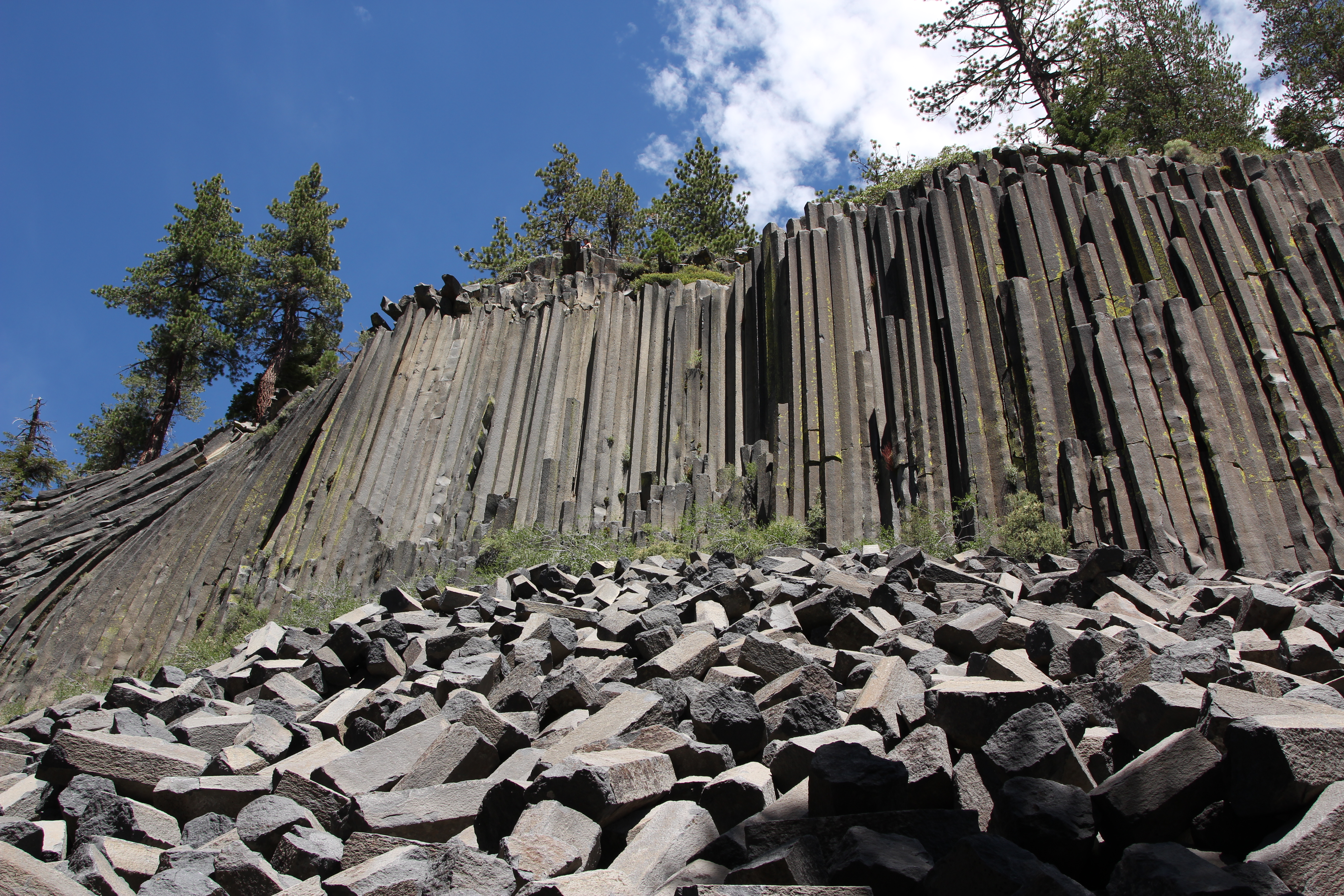
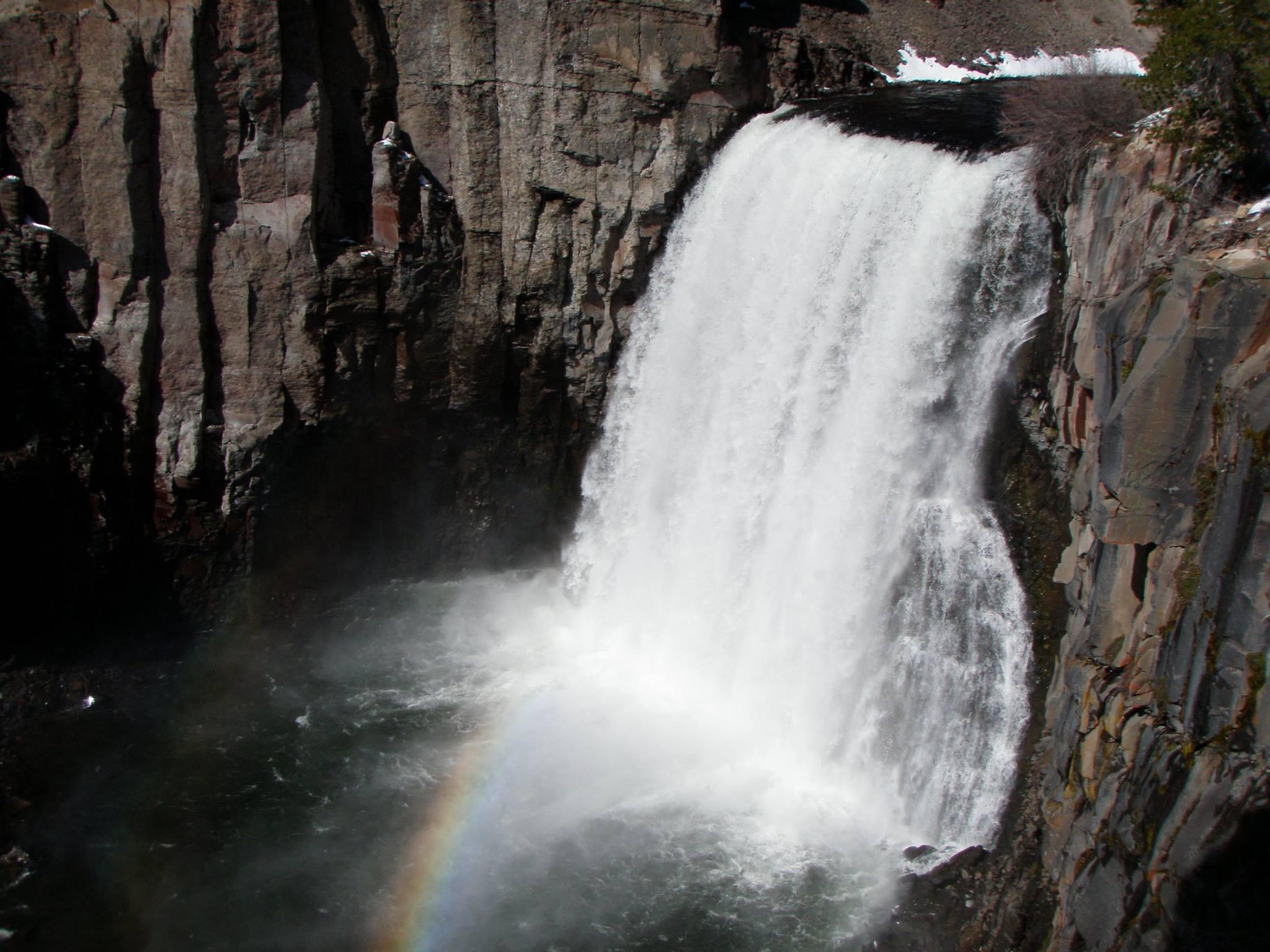
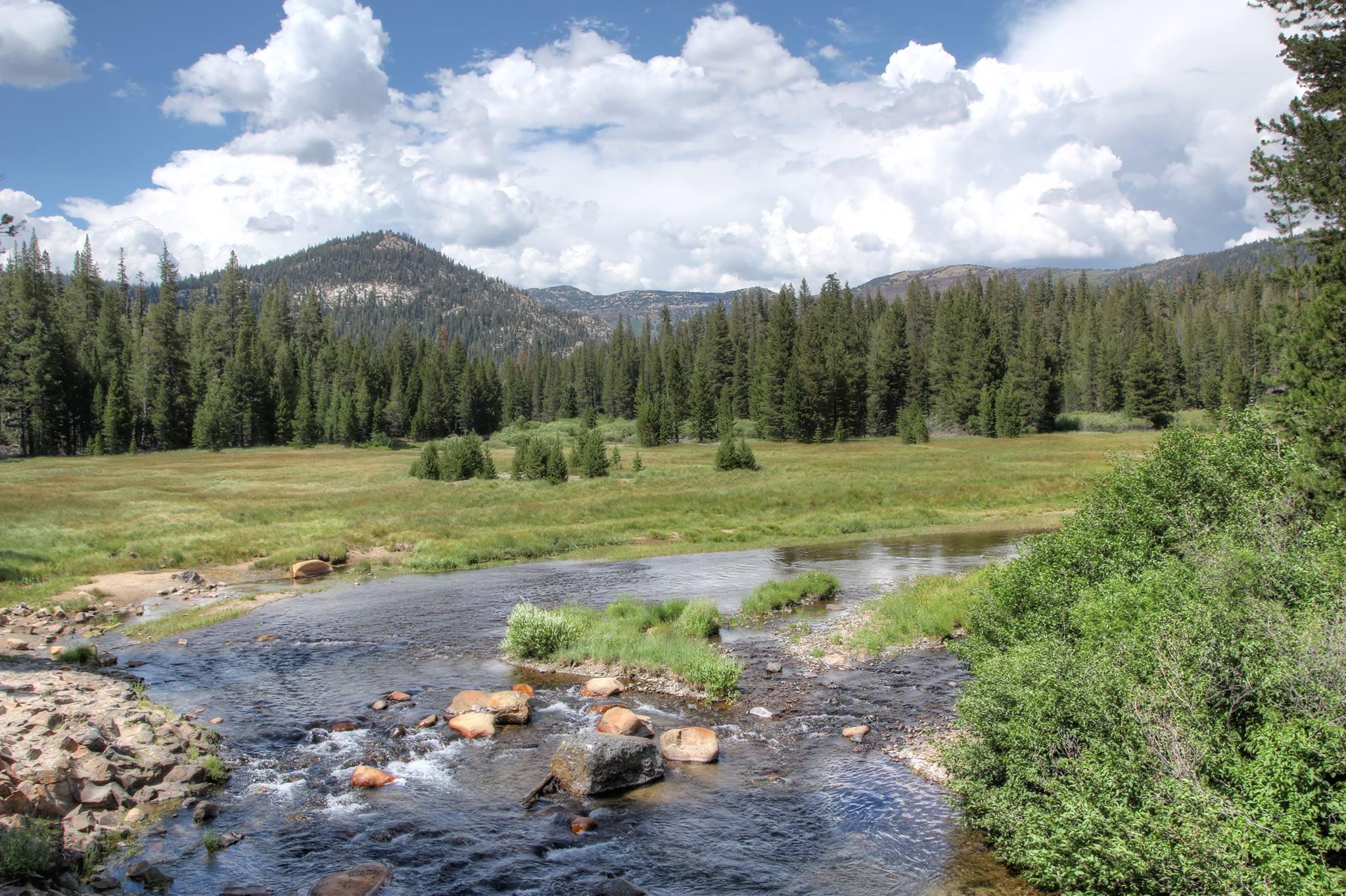
Devils Postpile National Monument is a U.S. national monument located near Mammoth Mountain in Eastern California. The monument protects Devils Postpile, an unusual rock formation of columnar basalt, "all closely and perfectly fitted together like a vast mosaic". The monument encompasses 798 acres (323 ha) and includes two main attractions: the Devils Postpile formation and Rainbow Falls, a waterfall on the Middle Fork of the San Joaquin River. In addition, the John Muir Trail and Pacific Crest Trail merge into one trail as they pass through the monument. Excluding a small developed area containing the monument headquarters, visitor center and a campground, the National Monument lies within the borders of the Ansel Adams Wilderness.
About Devils Postpile National Monument
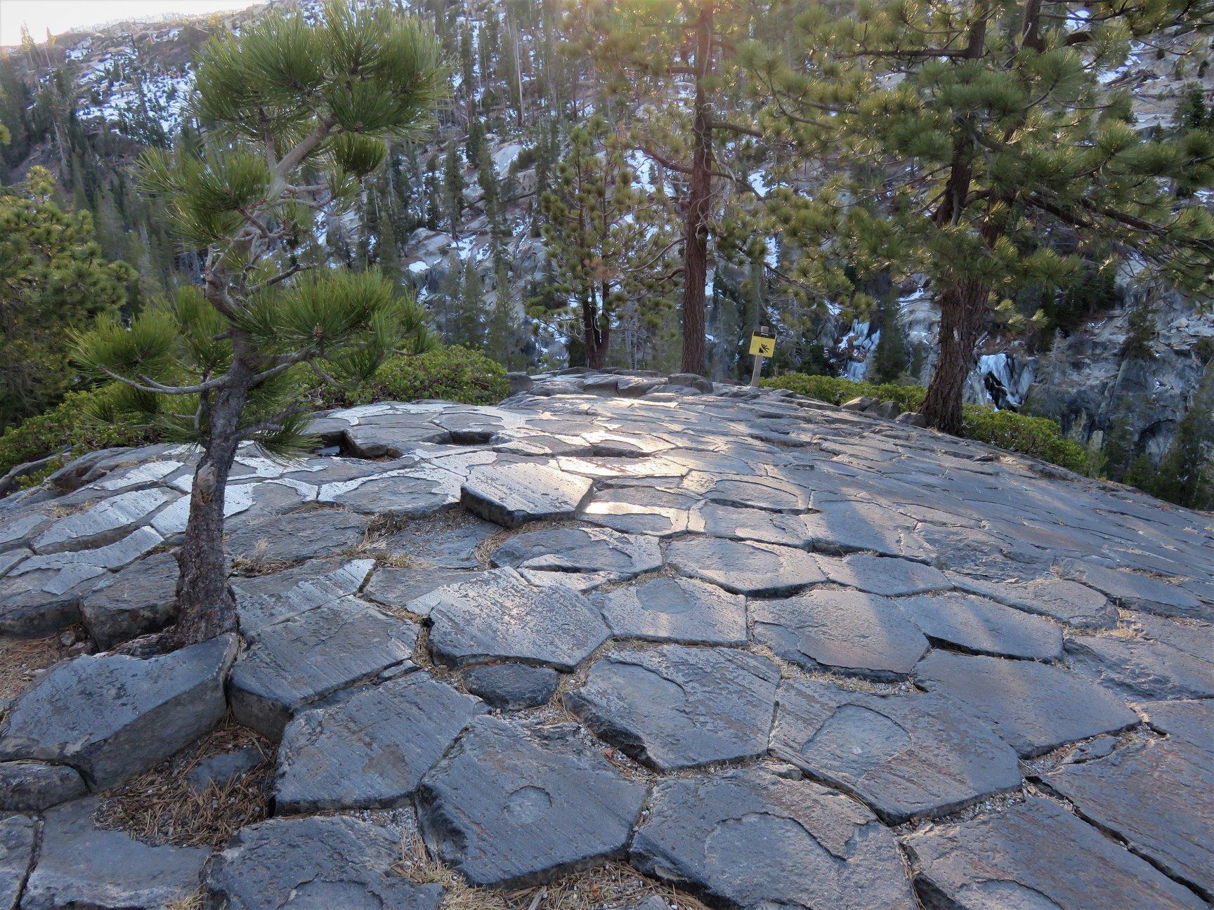
Established in 1911 by presidential proclamation, Devils Postpile National Monument protects and preserves the Devils Postpile formation, the 101-foot high Rainbow Falls, and pristine mountain scenery. The formation is a rare sight in the geologic world and ranks as one of the world's finest examples of columnar basalt. Its' columns tower up to 60 feet and display a striking symmetry.
Park Photos
Activities
Operating Hours
Devils Postpile National Monument
In the operating season, Devils Postpile National Monument is open 24 hours a day, 7 days a week. The Monument usually opens in mid-June. By mid to late October, early winter storms in the High Sierra typically begin to bring snow to the area.
| mon | tue | wed | thu | fri | sat | sun |
|---|---|---|---|---|---|---|
| All Day | All Day | All Day | All Day | All Day | All Day | All Day |
Frequently Asked Questions
How much does it cost to enter Devils Postpile National Monument?
Devils Postpile National Monument is free to enter.
What are the best activities at Devils Postpile National Monument?
Popular activities at Devils Postpile National Monument include: Astronomy, Stargazing, Biking, Road Biking, Camping, Car or Front Country Camping, Fishing, Hiking.
What is the weather like at Devils Postpile National Monument?
Devils Postpile National Monument is located at 7,560 feet above sea level just west of the Sierra Nevada crest. As such, it experiences typical summer weather in the Sierras. Afternoon thunderstorms are possible in July and August. Daytime temperatures can range from the mid-70s to to mid-80s (degrees Fahrenheit). Evening temperatures can drop into the low 40s (and even the low 30s in the months of September and October).
How do I get to Devils Postpile National Monument?
Shuttle Bus: Most visitors must park at the Mammoth Mountain Ski Area and use the mandatory shuttle. The shuttle bus operates from mid-June through the Wednesday after Labor Day. By car: From U.S. Highway 395, drive 10 miles west on S.R. 203 to Minaret Vista and then another 8 miles on a paved, steep mountain road. Please note that this road is single lane for approximately 3 miles. By plane: The closest commercial airport is the Mammoth Lakes/Yosemite Airport (MMH), located on U.S. Highway 395.
Entrance Fees
Free Admission
Weather
Devils Postpile National Monument is located at 7,560 feet above sea level just west of the Sierra Nevada crest. As such, it experiences typical summer weather in the Sierras. Afternoon thunderstorms are possible in July and August. Daytime temperatures can range from the mid-70s to to mid-80s (degrees Fahrenheit). Evening temperatures can drop into the low 40s (and even the low 30s in the months of September and October).
Directions
Shuttle Bus: Most visitors must park at the Mammoth Mountain Ski Area and use the mandatory shuttle. The shuttle bus operates from mid-June through the Wednesday after Labor Day. By car: From U.S. Highway 395, drive 10 miles west on S.R. 203 to Minaret Vista and then another 8 miles on a paved, steep mountain road. Please note that this road is single lane for approximately 3 miles. By plane: The closest commercial airport is the Mammoth Lakes/Yosemite Airport (MMH), located on U.S. Highway 395.
📍 View on Google Maps →Location
Official Resources
NPS Official WebsiteMore Parks in California
Other national park sites you might enjoy