Fire Island National Seashore
National Seashore · New York
NPS Photo

National park system unit in New York, United States
Fire Island National Seashore (FINS) is a United States National Seashore that protects a 26-mile (42 km) section of Fire Island, an approximately 30-mile (48 km) long and 0.5-mile (0.80 km) wide barrier island separated from Long Island by the Great South Bay. The island is part of New York State's Suffolk County and the Outer Barrier.
About Fire Island National Seashore
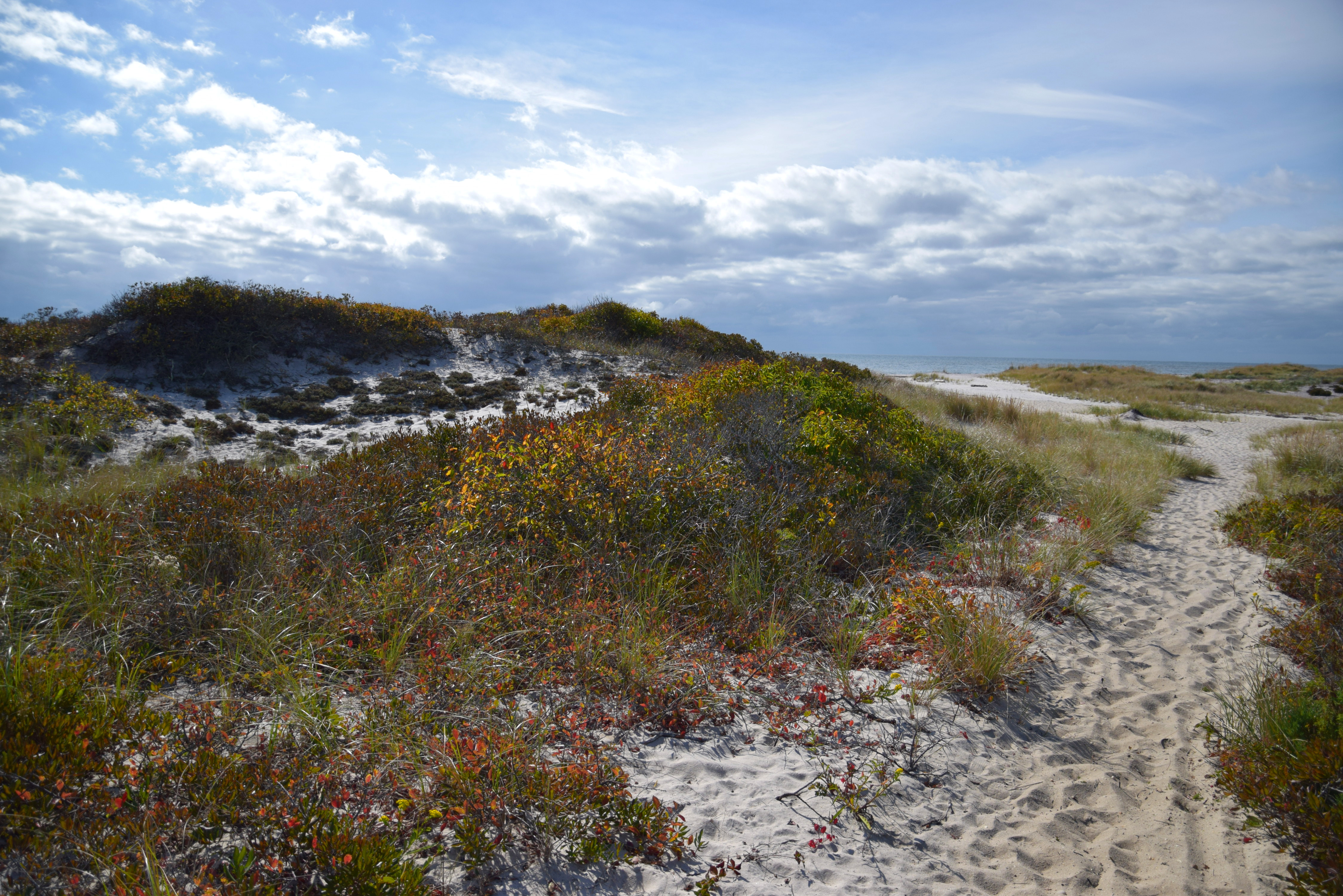
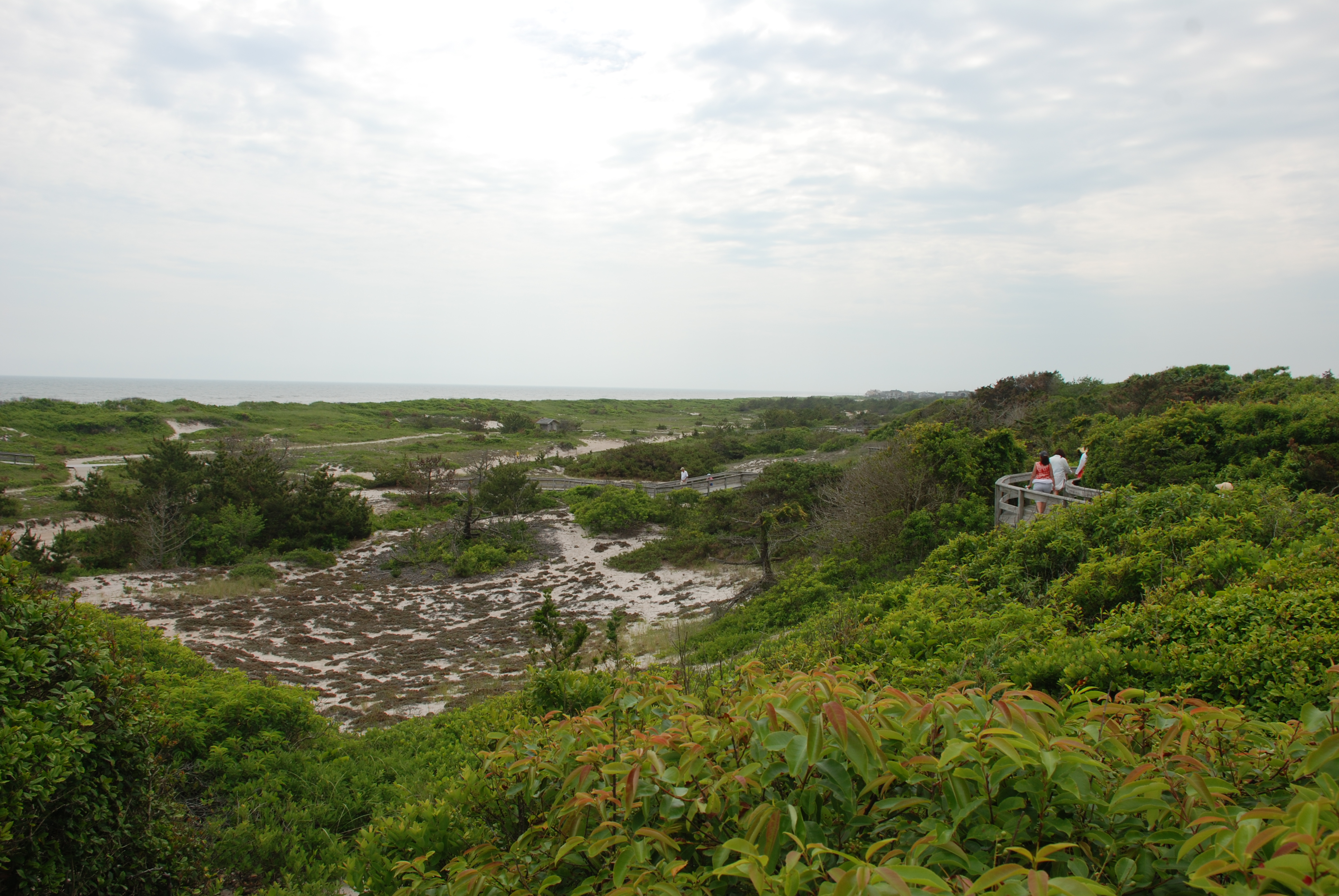
Immerse yourself in an enchanting collage of coastal life and history. Rhythmic waves, high dunes, ancient maritime forests, historic landmarks and glimpses of wildlife, Fire Island has been a special place for diverse plants, animals and people for centuries. Far from the pressure of nearby big-city life, dynamic barrier island beaches offer solitude, camaraderie, and spiritual renewal.
Park Photos
Activities
Operating Hours
Fire Island National Seashore
Fire Island National Seashore encompasses five National Park Service sites on Fire Island, and headquarters and the William Floyd Estate on Long Island. The Fire Island Lighthouse, the William Floyd Estate and Wilderness Visitor Center are open year-round. Watch Hill and Sailors Haven on Fire Island are open seasonally. Please be sure to check the hours of operations and the exceptions tab for each site you plan to visit.
| mon | tue | wed | thu | fri | sat | sun |
|---|---|---|---|---|---|---|
| All Day | All Day | All Day | All Day | All Day | All Day | All Day |
Frequently Asked Questions
How much does it cost to enter Fire Island National Seashore?
Fire Island National Seashore is free to enter.
What are the best activities at Fire Island National Seashore?
Popular activities at Fire Island National Seashore include: Arts and Culture, Astronomy, Stargazing, Boating, Camping, Backcountry Camping, Fishing, Food.
What is the weather like at Fire Island National Seashore?
Spring: Temperatures may range from high 30s to low 50s (F). Rain and sun are equally common. Summer: Temperatures usually range from 65 F to 90 F. Fall: Temperatures from 70 F in early autumn to 40 F later in the season may be expected. Winter: Temperatures in the 30s (F) are common, with below freezing temperatures possible.
How do I get to Fire Island National Seashore?
Fire Island National Seashore Headquarters are located in Patchogue, New York, on Long Island. Fire Island National Seashore Headquarters: Via Long Island Expressway/I-495: Take Exit 61 (Patchogue-Holbrook Road) to Waverly Ave. Head south on Waverly Ave to West Ave. Turn right onto Laurel Street. Via NY-27: Take Exit 52 onto Waverly Ave. Head south on Waverly Ave to West Ave. Turn right onto Laurel Street.
Entrance Fees
Free Admission
Weather
Spring: Temperatures may range from high 30s to low 50s (F). Rain and sun are equally common. Summer: Temperatures usually range from 65 F to 90 F. Fall: Temperatures from 70 F in early autumn to 40 F later in the season may be expected. Winter: Temperatures in the 30s (F) are common, with below freezing temperatures possible.
Directions
Fire Island National Seashore Headquarters are located in Patchogue, New York, on Long Island. Fire Island National Seashore Headquarters: Via Long Island Expressway/I-495: Take Exit 61 (Patchogue-Holbrook Road) to Waverly Ave. Head south on Waverly Ave to West Ave. Turn right onto Laurel Street. Via NY-27: Take Exit 52 onto Waverly Ave. Head south on Waverly Ave to West Ave. Turn right onto Laurel Street.
📍 View on Google Maps →Location
Official Resources
NPS Official WebsiteMore Parks in New York
Other national park sites you might enjoy