Lower Delaware National Wild and Scenic River
National Wild and Scenic River · Pennsylvania, New Jersey
NPS Photo/Julia Bell

Section of river in Pennsylvania and New Jersey
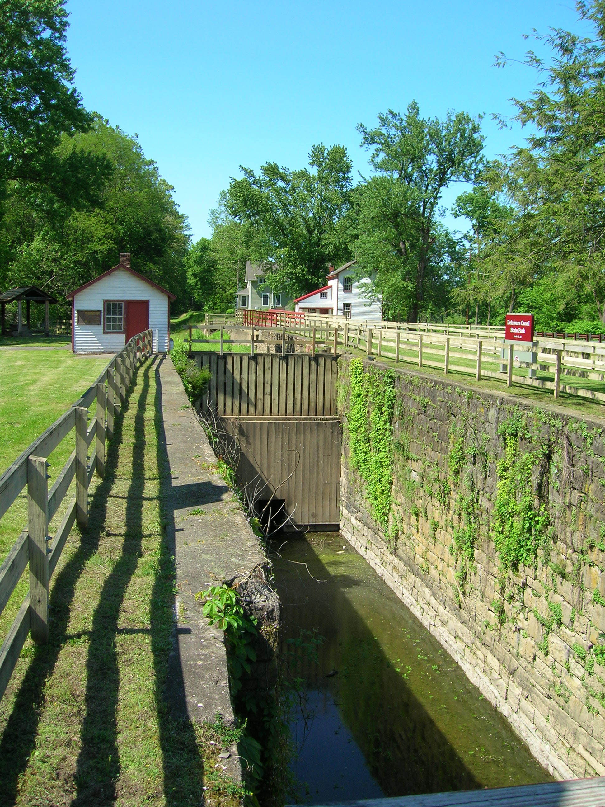
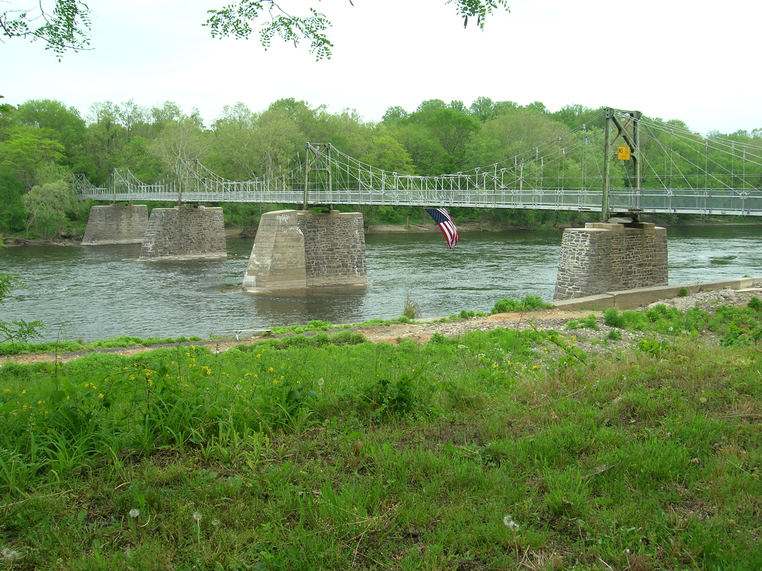
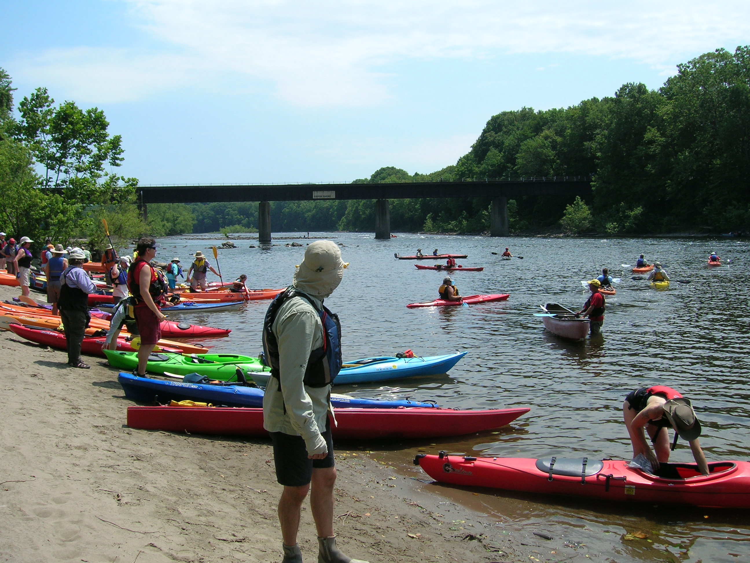
The Lower Delaware National Wild and Scenic River is a federally designated area of the Delaware River protected under the National Wild and Scenic Rivers System in Pennsylvania and New Jersey. The designation also includes sections of Paunnacussing Creek, Tohickon Creek, Tinicum Creek, Rapp Creek, and Beaver Creek. In total, the protection covers 67.3 miles (108.3 km) miles of waterways.
About Lower Delaware National Wild and Scenic River
The Delaware River, the largest free-flowing river in the eastern United States, runs past forests, farmlands and villages. It also links some of the most densely populated regions in America. In 2000, the National Wild and Scenic River System incorporated key segments of the lower Delaware River to form this unit of the National Park System.
Park Photos
Activities
Operating Hours
Lower Delaware National Wild and Scenic River
The largest free-flowing river in the eastern United States, the Delaware River runs past forests, farmlands, and villages, and it also links some of the most densely populated regions in America. In 2000, the National Wild and Scenic River System incorporated key segments of the lower Delaware River to form this unit of the National Park System.
| mon | tue | wed | thu | fri | sat | sun |
|---|---|---|---|---|---|---|
| Sunrise to Sunset | Sunrise to Sunset | Sunrise to Sunset | Sunrise to Sunset | Sunrise to Sunset | Sunrise to Sunset | Sunrise to Sunset |
Frequently Asked Questions
How much does it cost to enter Lower Delaware National Wild and Scenic River?
Lower Delaware National Wild and Scenic River is free to enter.
What are the best activities at Lower Delaware National Wild and Scenic River?
Popular activities at Lower Delaware National Wild and Scenic River include: Auto and ATV, Scenic Driving, Boating, Camping, Fishing, Food, Picnicking, Hiking.
What is the weather like at Lower Delaware National Wild and Scenic River?
Spring: Temperatures usually range from lows of 26 F to highs of 80 F with average rainfall of 5 inches. Summer: Temperatures usually range from lows of 55 F to highs of 85 F with average rainfall of 4 inches. Fall: Temperatures usually range from lows of 30 F to highs of 83F. Fall foliage is at its peak sometime in October as daily mountain temperatures vary frequently and influence the change. Winter: Temperatures usually range from lows of 15 F to highs of 49 F.
How do I get to Lower Delaware National Wild and Scenic River?
The Lower Delaware National Wild and Scenic River is located between Interstate 80 (at Portland, Pennsylvania and Columbia, New Jersey) and Interstate 95 (at exit 51 in Washington Crossing, Pennsylvania and exit 1 in Washington Crossing, New Jersey). In Pennsylvania, follow PA-611 and PA-32 to drive along the river. In New Jersey, follow NJ-29 south of Frenchtown for a drive along the river.
Entrance Fees
Free Admission
Weather
Spring: Temperatures usually range from lows of 26 F to highs of 80 F with average rainfall of 5 inches. Summer: Temperatures usually range from lows of 55 F to highs of 85 F with average rainfall of 4 inches. Fall: Temperatures usually range from lows of 30 F to highs of 83F. Fall foliage is at its peak sometime in October as daily mountain temperatures vary frequently and influence the change. Winter: Temperatures usually range from lows of 15 F to highs of 49 F.
Directions
The Lower Delaware National Wild and Scenic River is located between Interstate 80 (at Portland, Pennsylvania and Columbia, New Jersey) and Interstate 95 (at exit 51 in Washington Crossing, Pennsylvania and exit 1 in Washington Crossing, New Jersey). In Pennsylvania, follow PA-611 and PA-32 to drive along the river. In New Jersey, follow NJ-29 south of Frenchtown for a drive along the river.
📍 View on Google Maps →Location
Official Resources
NPS Official WebsiteMore Parks in Pennsylvania
Other national park sites you might enjoy
Allegheny Portage Railroad National Historic Site
National Historic Site · Free

Appalachian National Scenic Trail
National Scenic Trail · Free
Captain John Smith Chesapeake National Historic Trail
National Historic Trail · Free

Carlisle Federal Indian Boarding School National Monument
National Monument · Free