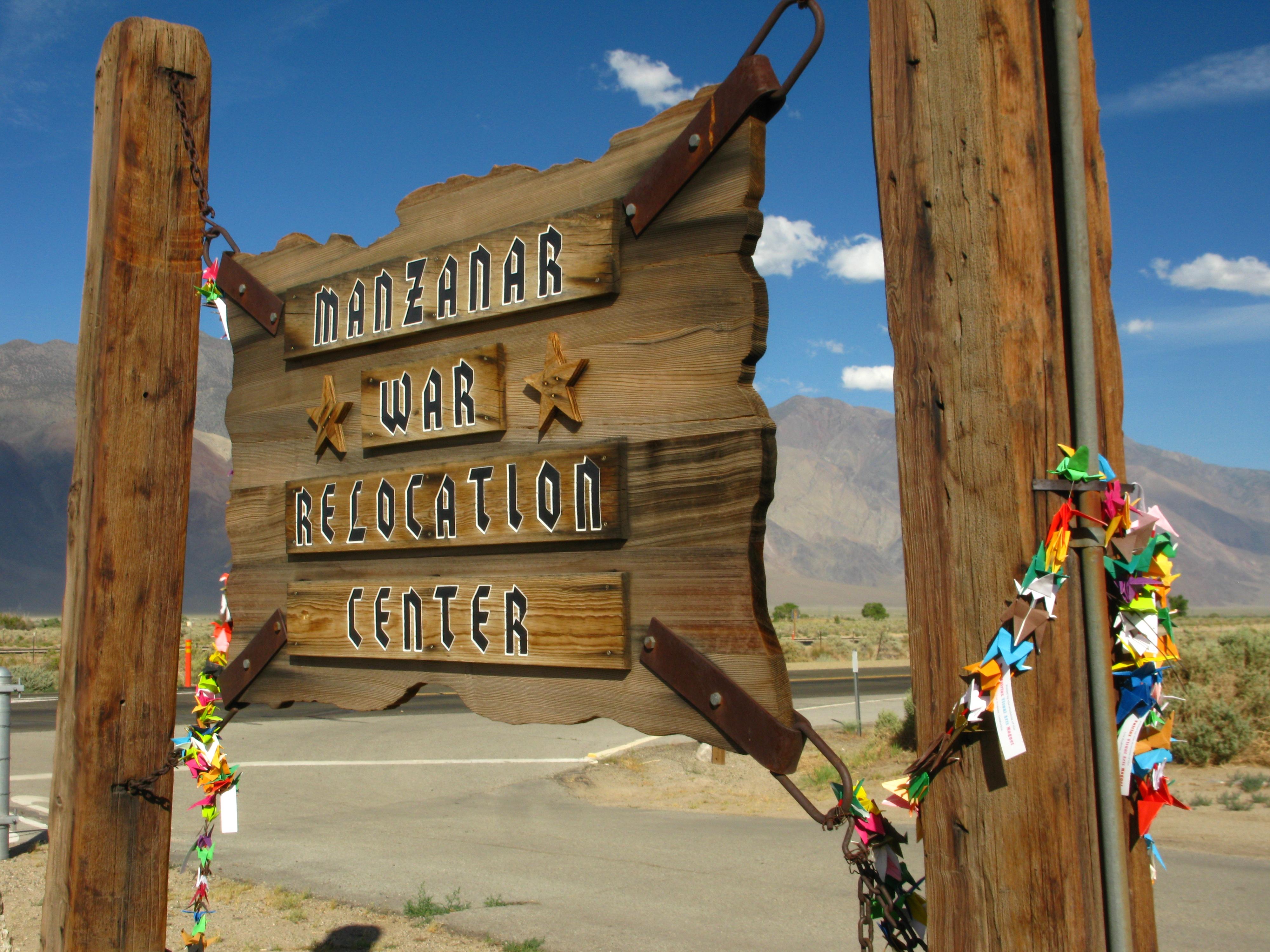
Manzanar National Historic Site
National Historic Site · California
Dorothea Lange

World War II internment camp in California, US
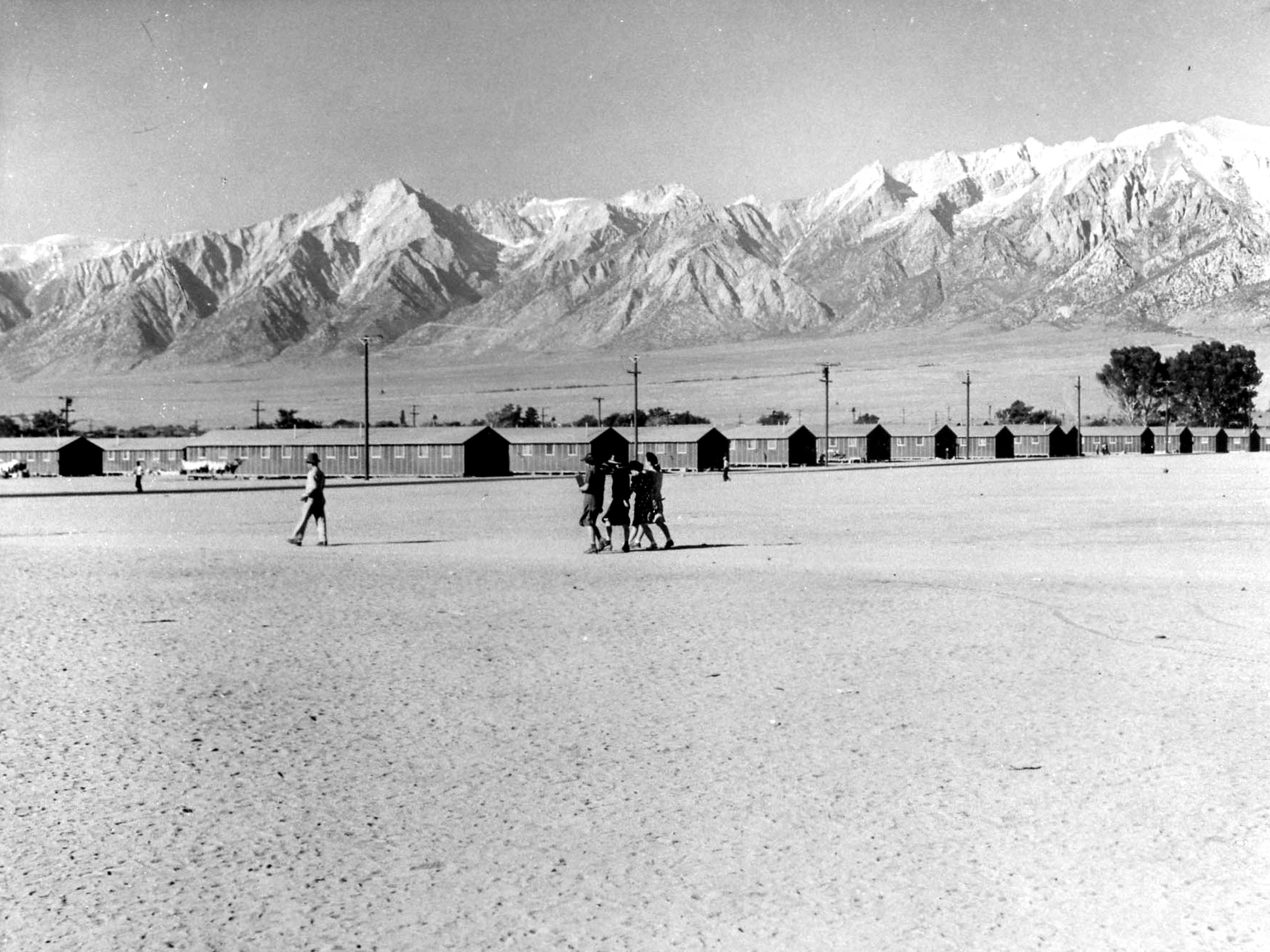
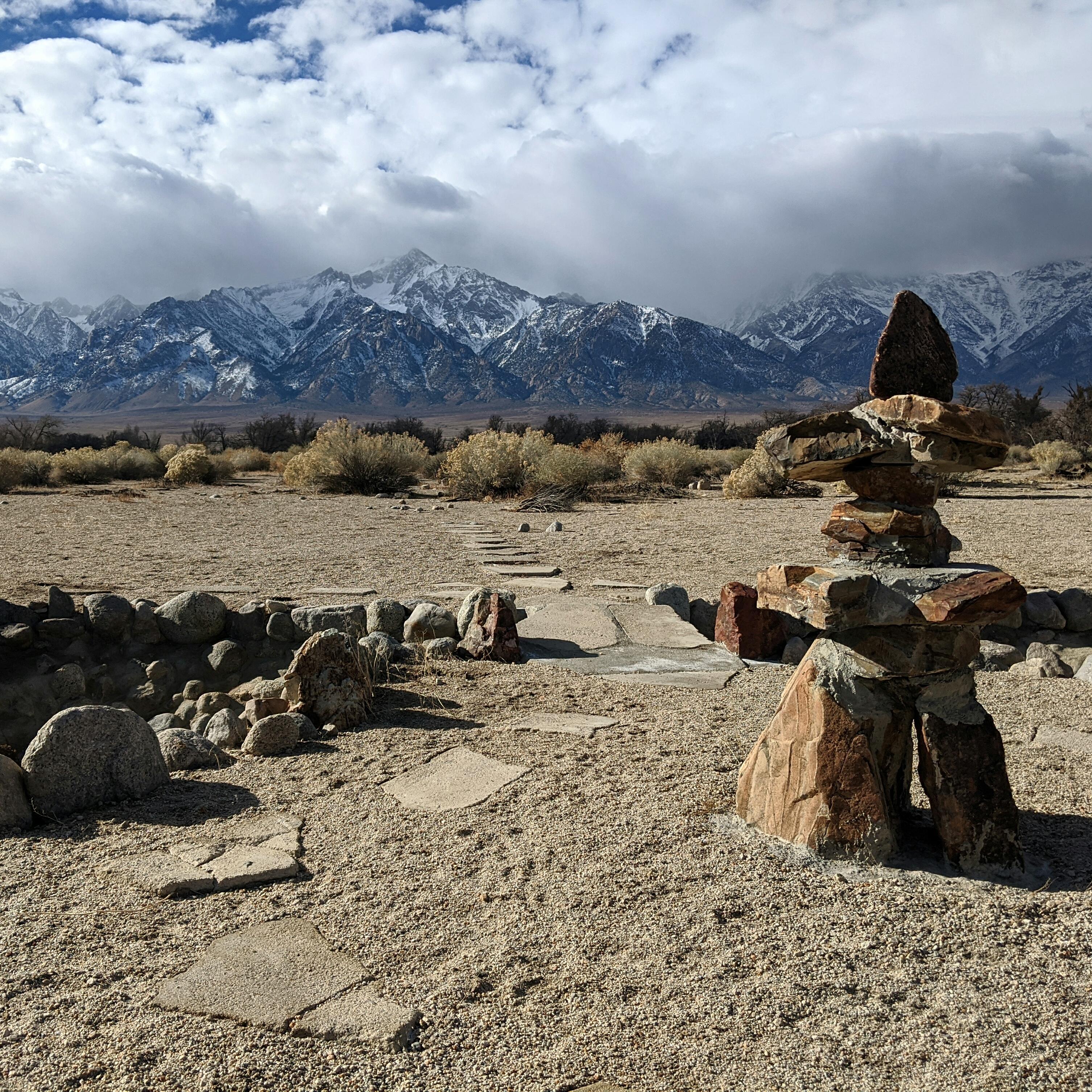
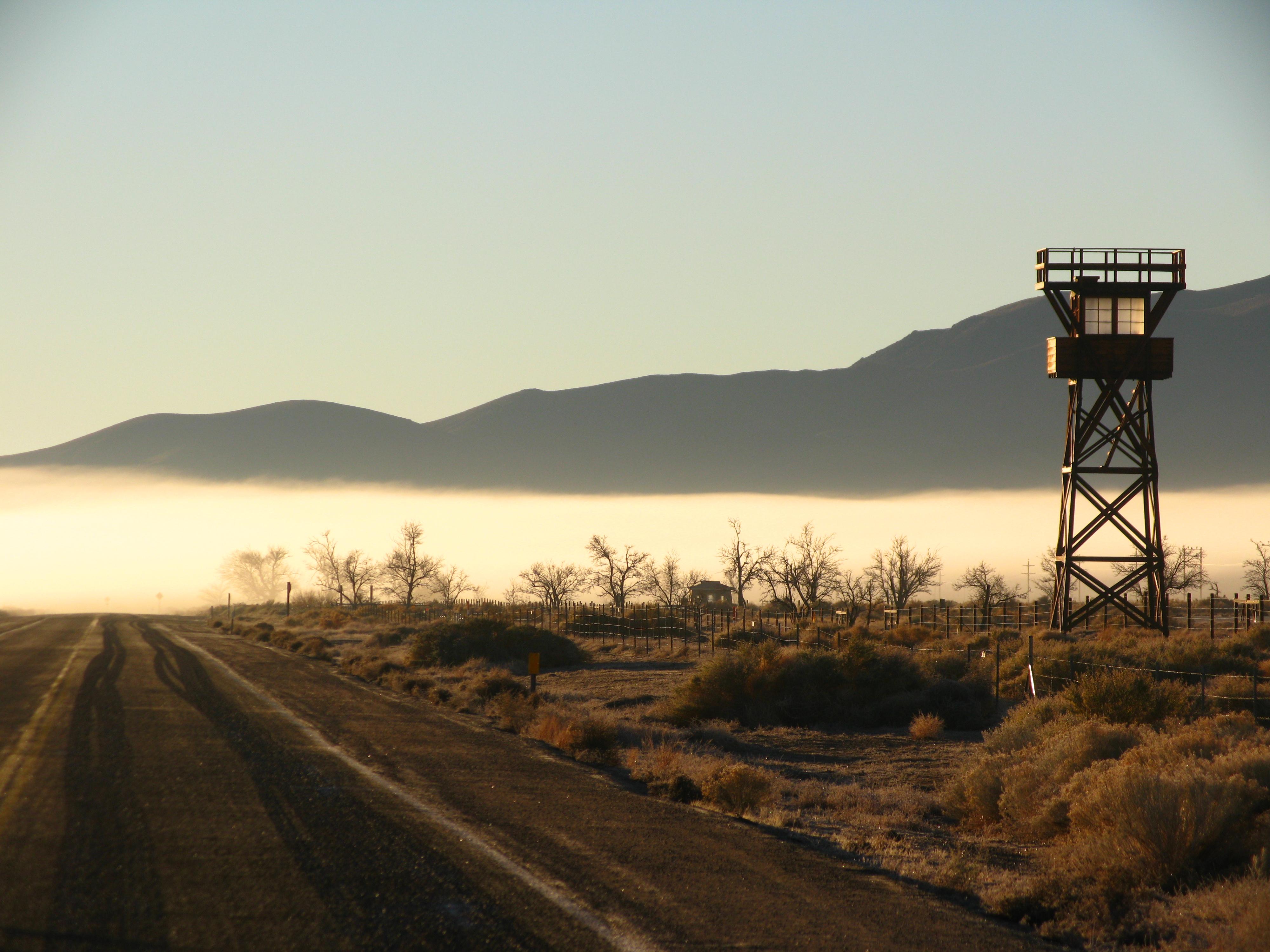
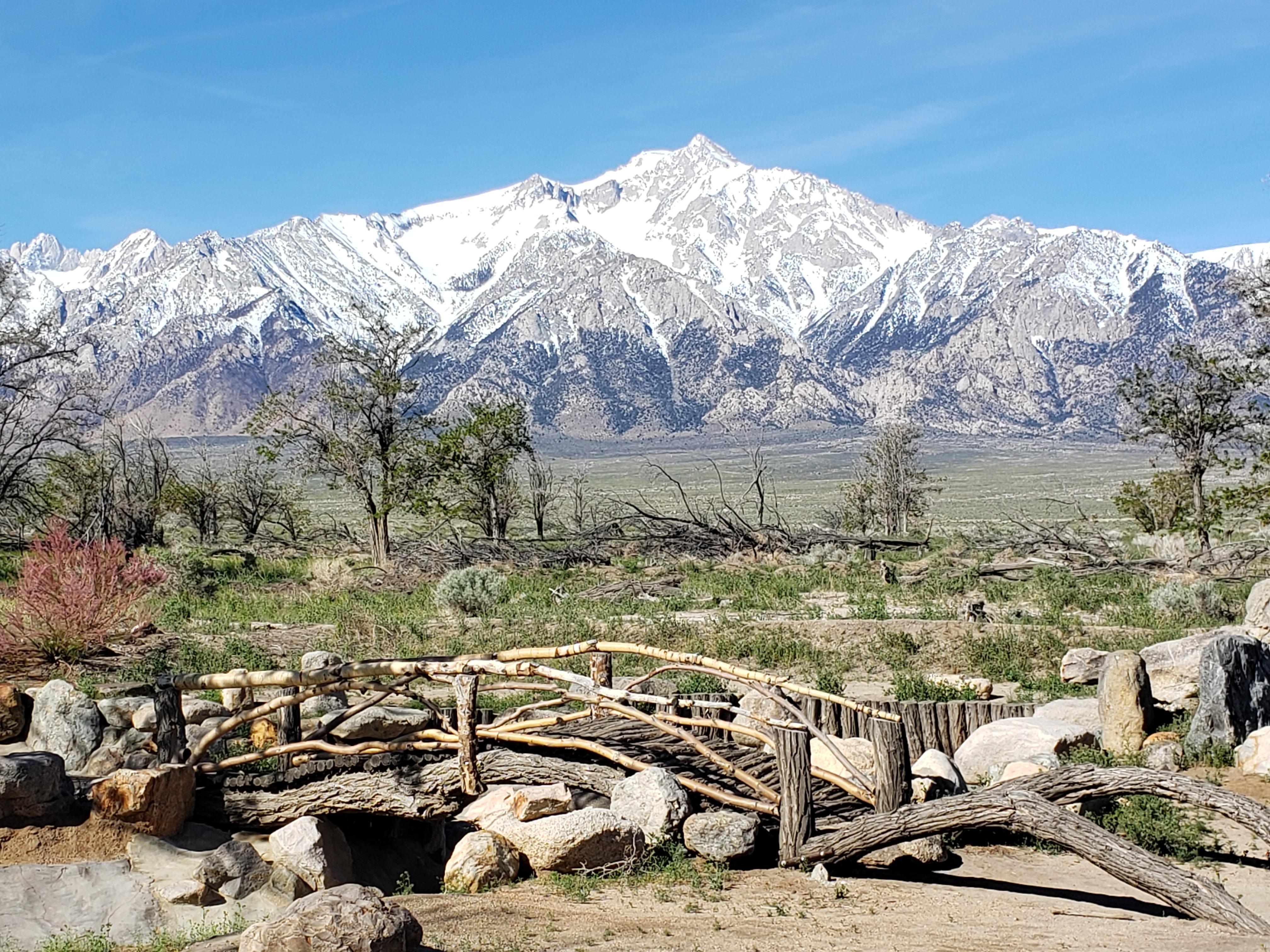
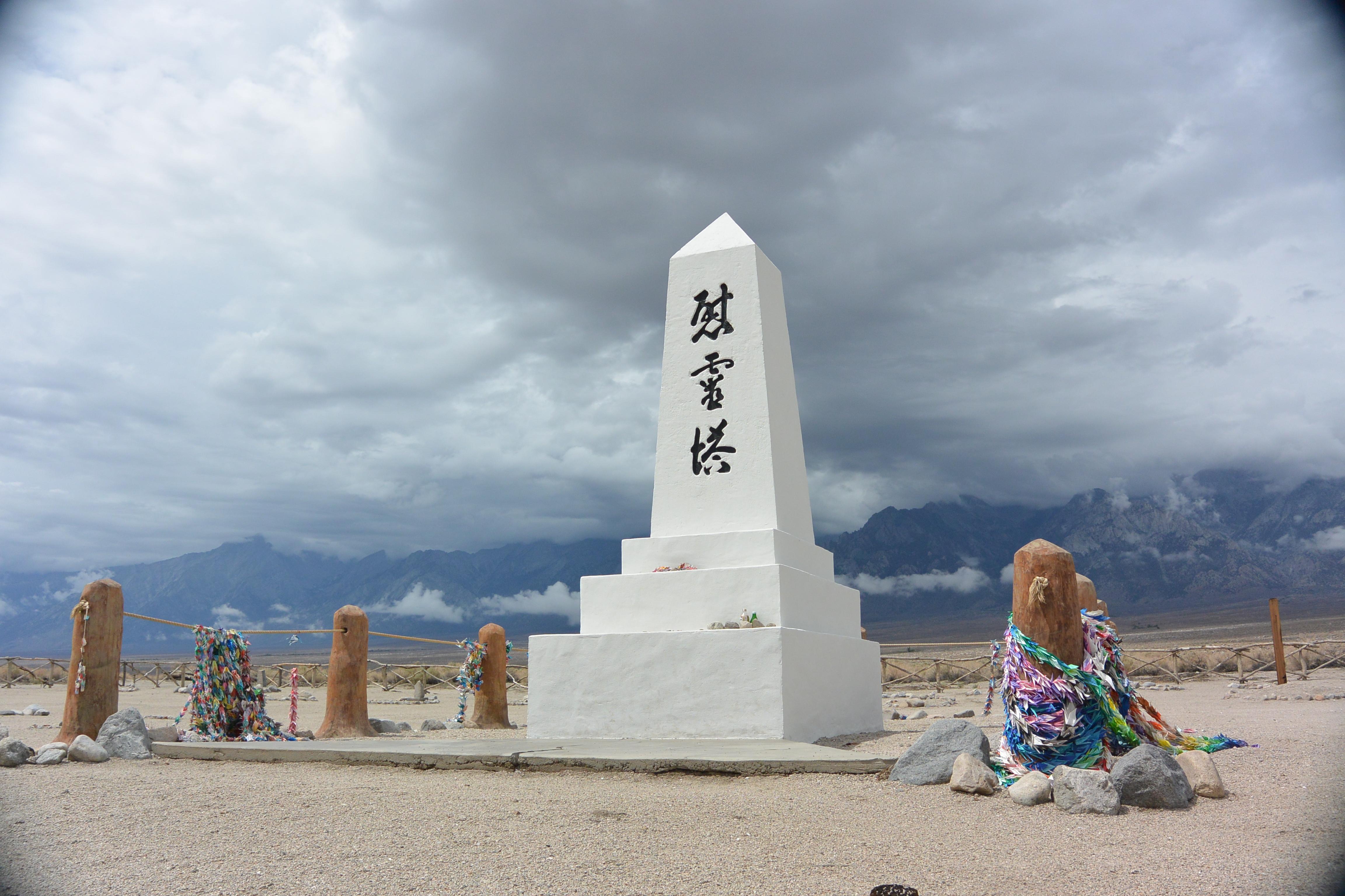
Manzanar is the site of one of ten American concentration camps, where more than 120,000 Japanese Americans were incarcerated during World War II, from March 1942 to November 1945. Although it had over 10,000 inmates at its peak, Manzanar was one of the smaller internment camps. It is located in California's Owens Valley, on the eastern side of the Sierra Nevada mountains, between the towns of Lone Pine to the south and Independence to the north, approximately 230 miles (370 km) north of Los Angeles. Manzanar means "apple orchard" in Spanish. The Manzanar National Historic Site, which preserves and interprets the legacy of Japanese American incarceration in the United States, was identified by the United States National Park Service as the best-preserved of the ten former camp sites.
About Manzanar National Historic Site
In 1942, the United States government ordered more than 110,000 men, women, and children to leave their homes and detained them in remote, military-style camps. Manzanar War Relocation Center was one of ten camps where the US government incarcerated Japanese immigrants ineligible for citizenship and Japanese American citizens during World War II.
Park Photos
Activities
Operating Hours
Site Grounds
The driving tour and grounds remain open daily from sunrise to sunset. Visitor center hours are more limited. See visitor center hours section for more information. The Block 14 building exhibits are open 9:00 am - 4:15 pm daily, except for Christmas Day when they are closed.
| mon | tue | wed | thu | fri | sat | sun |
|---|---|---|---|---|---|---|
| Sunrise to Sunset | Sunrise to Sunset | Sunrise to Sunset | Sunrise to Sunset | Sunrise to Sunset | Sunrise to Sunset | Sunrise to Sunset |
Frequently Asked Questions
How much does it cost to enter Manzanar National Historic Site?
Manzanar National Historic Site is free to enter.
What are the best activities at Manzanar National Historic Site?
Popular activities at Manzanar National Historic Site include: Biking, Road Biking, Food, Picnicking, Guided Tours, Self-Guided Tours - Walking, Self-Guided Tours - Auto, Bus/Shuttle Guided Tour.
What is the weather like at Manzanar National Historic Site?
Manzanar is located in the Owens Valley at 4,000' elevation, at the eastern base of the Sierra Nevada. We get little precipitation but we do have four distinct seasons. Summer temperatures can soar over 100 degrees. Winter highs are usually in the 40's. Nighttime temperatures year round are 30 to 40 degrees less than daytime highs. High winds are common in any season.
How do I get to Manzanar National Historic Site?
Manzanar is located on the west side of U.S. Highway 395, 9 miles north of Lone Pine, California and 6 miles south of Independence, CA.
Entrance Fees
Free Admission
Weather
Manzanar is located in the Owens Valley at 4,000' elevation, at the eastern base of the Sierra Nevada. We get little precipitation but we do have four distinct seasons. Summer temperatures can soar over 100 degrees. Winter highs are usually in the 40's. Nighttime temperatures year round are 30 to 40 degrees less than daytime highs. High winds are common in any season.
Directions
Manzanar is located on the west side of U.S. Highway 395, 9 miles north of Lone Pine, California and 6 miles south of Independence, CA.
📍 View on Google Maps →Location
Official Resources
NPS Official WebsiteMore Parks in California
Other national park sites you might enjoy